A Beartooth Highway road trip is 68 miles of US 212 between Red Lodge, Montana, and Cooke City, Montana — and inside that short distance the road climbs from valley ranchland to a 10,947-foot pass on a shelf of switchbacks blasted into the mountainside, then drops back down to Yellowstone's back door. CBS correspondent Charles Kuralt called it "the most beautiful drive in America," and it's one of the shortest marquee drives on this blog: doable as a half-day out-and-back or as the opening act of a Yellowstone trip. Here's what the route actually looks like mile by mile, the short season that governs everything about planning it, honest pacing, and the fuel and altitude logistics that catch first-timers.
The Beartooth Highway, in four decisions
- Check that it's actually open — the highway runs roughly Memorial Day weekend through mid-October, weather permitting on both ends, and some years it closes earlier than the target date.
- Start early and dress for four seasons in one day — the pass sits near 11,000 feet, where snow, wind, and afternoon thunderstorms are normal even in July.
- Fill the tank in Red Lodge or Cooke City — there's exactly one seasonal store roughly halfway, and it isn't a substitute for a full tank.
- Decide if you're doing an out-and-back or a loop — the Chief Joseph Scenic Byway turns a one-way drive into a two-day loop through Cody, Wyoming, instead of backtracking.
What the Beartooth Highway actually is
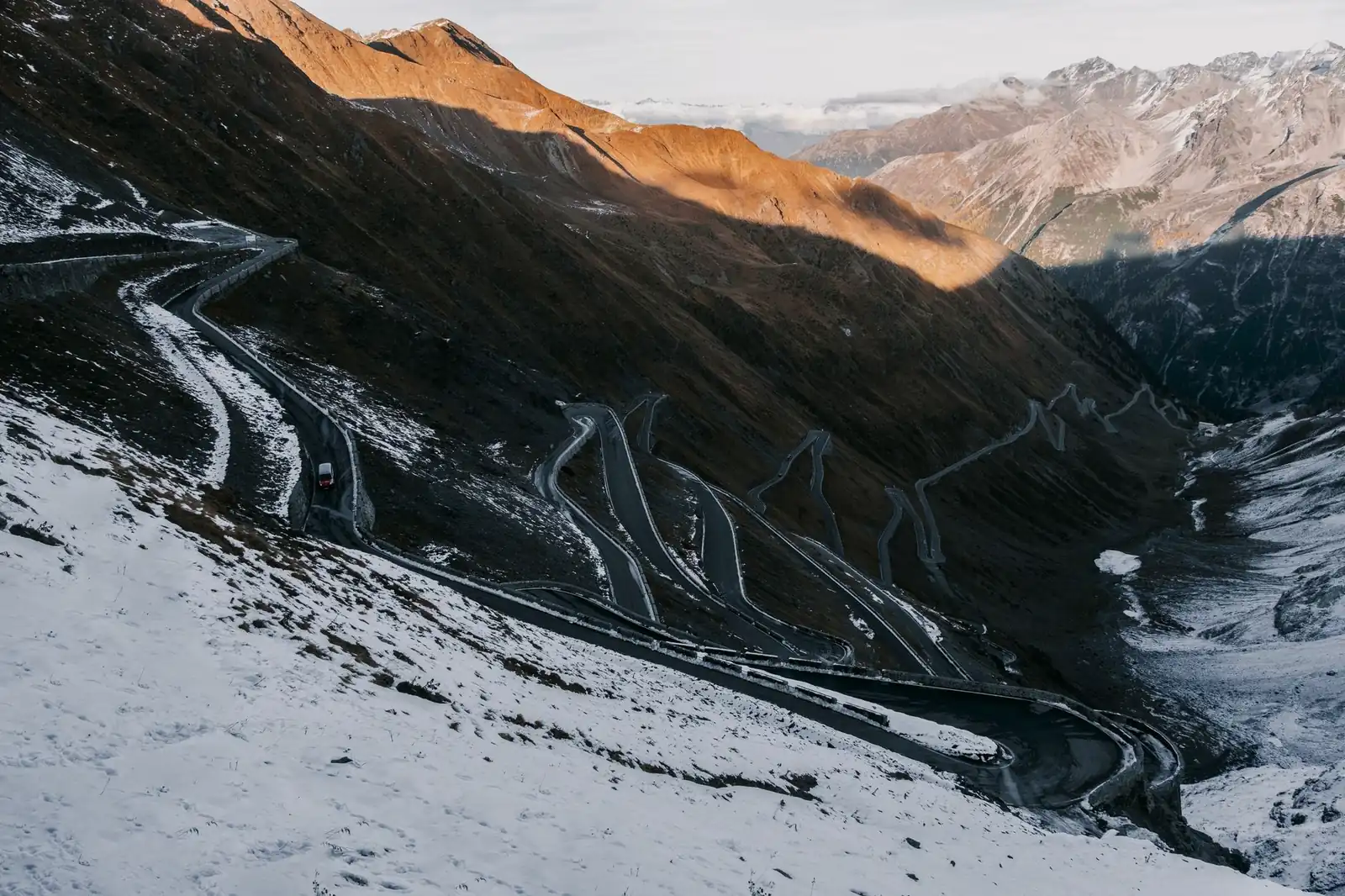
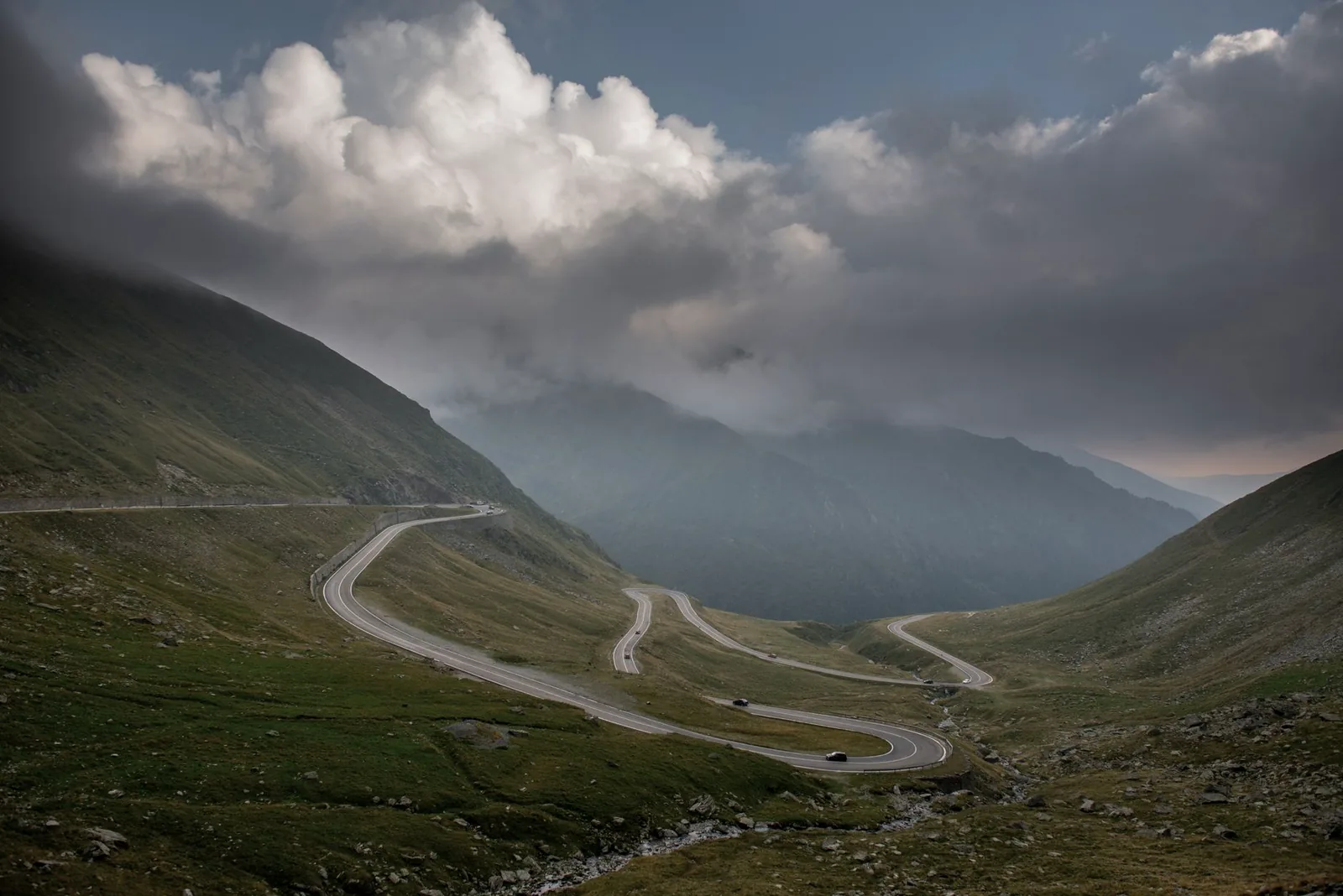
The Beartooth Highway is the 68-mile stretch of US 212 connecting Red Lodge, Montana, to Cooke City, Montana, just outside Yellowstone National Park's northeast entrance. It opened in 1936 and carries the federal government's highest scenic-road designation, an All-American Road, on top of its National Scenic Byway status. The pull of the road is almost entirely vertical: from Red Lodge's ranch-valley floor, the highway climbs roughly a vertical mile in about a dozen miles of switchbacks to Beartooth Pass, at 10,947 feet the second-highest paved highway pass in Wyoming and Montana. Above treeline, the drive turns into something closer to alpine tundra than a mountain road — wind-scoured plateau, snowfields that can linger into August, and views that run for a hundred miles on a clear day.
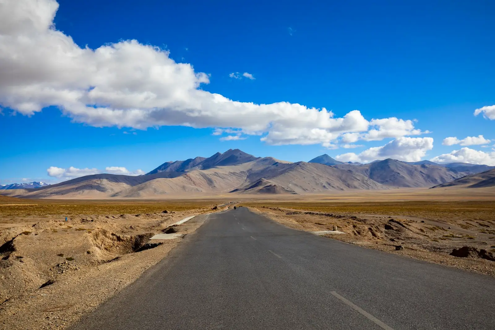
One quirk worth knowing before you go: Montana's transportation department maintains the highway only to the Wyoming border, where the National Park Service takes over — even though the road isn't inside Yellowstone or any other park unit. Wyoming's own DOT determined decades ago that the alpine section didn't meet standard state-highway specs, so the Park Service has kept plowing and paving it ever since. It's a small bureaucratic oddity that explains why a road nowhere near a park entrance shows up on NPS maintenance schedules.
The route: three characters in 68 miles
Unlike most of the multi-day drives on this blog, the Beartooth Highway is short enough to describe stretch by stretch rather than day by day:
| Section | Character | Don't-miss stops |
|---|---|---|
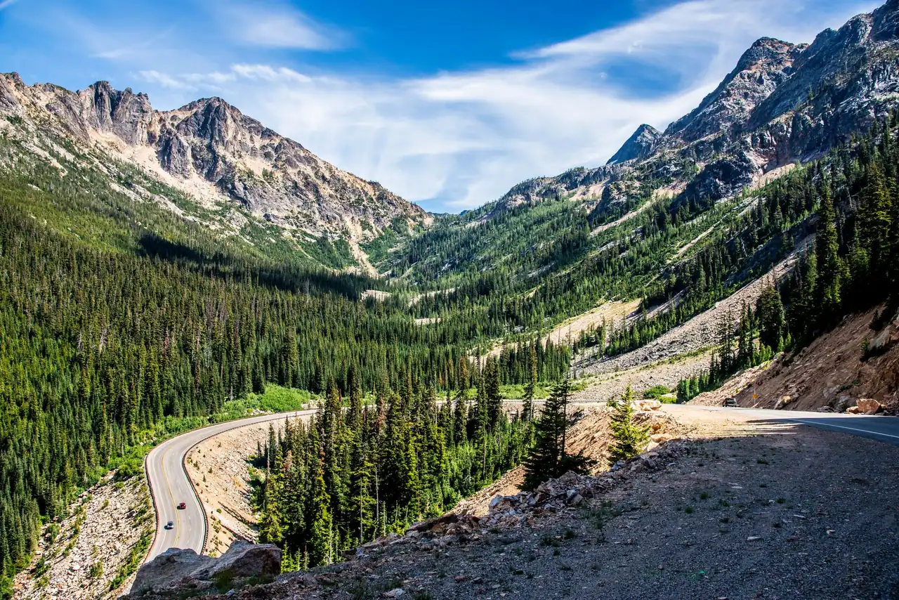
| Red Lodge to Rock Creek Vista Point | The warm-up climb — forested canyon walls give way to open alpine views as the road gains elevation fast | Rock Creek Vista Point, an easy pullout with a boardwalk overlook of the switchbacks still to come |
| The switchbacks to Beartooth Pass | The famous part — a series of hairpin turns climbing the headwall to the Wyoming border and the 10,947-ft pass, above treeline for the last stretch | The switchback overlooks themselves, Beartooth Lake, and — if you're there in early summer — skiers on the Twin Lakes headwall |
| Pass to Cooke City | A long, gentler descent across high plateau and past Top of the World, dropping back into forest near Yellowstone's boundary | Top of the World Store, Long Lake, the view down into the Clarks Fork valley |
A genuine curiosity near the pass: the Beartooth Basin Summer Ski Area operates on the Twin Lakes headwall for a few weeks each year, typically from around Memorial Day into early July, snow and staffing permitting — one of the only places in the country where you can watch skiers from a highway pullout in June. It's a small, weather-dependent operation rather than a resort, so treat any specific season dates as something to confirm the week you go rather than a fixed calendar.
Cooke City and its smaller neighbor Silver Gate sit right at the highway's western end, four miles from Yellowstone's northeast entrance — the quietest and least-developed of the park's five gates, and the way in for anyone continuing into the Lamar Valley rather than turning back toward Red Lodge.
When the Beartooth Highway is open
The Beartooth Highway is a seasonal road, closed under snow for roughly half the year. Per Montana DOT's own Beartooth Highway page, it's "generally open from the Friday of Memorial Day weekend through mid-October, weather permitting" — and 2026 bore that hedge out exactly: per the National Park Service's own release, the Wyoming section didn't open until May 23, 2026, a day later than targeted, after a late-season winter storm. The lesson isn't the specific date so much as the pattern: both ends of the season move around based on snowpack and weather, sometimes by days and sometimes by weeks, and the highway can also close for short stretches mid-summer during storms. Check MDT's 511 traveler map the morning you drive, not the week you booked the trip.
Altitude drives the rest of the timing logic. Near the pass, expect the possibility of snow, freezing wind, and afternoon thunderstorms in any month the road is open, including July. Mornings tend to be calmer and clearer than afternoons at this elevation, which is the same rhythm that governs most high-alpine drives on this blog — start early, and don't linger at the overlooks once clouds start building over the peaks.
How much time a Beartooth Highway trip needs
| Plan | What it buys |
|---|---|
| Half day, out-and-back from Red Lodge | Drive up to the pass or Beartooth Lake, walk the Rock Creek Vista boardwalk, and return the way you came — enough for the headline scenery without committing to Yellowstone |
| Full day, one-way to Cooke City | The whole 68 miles with stops, ending at Yellowstone's northeast entrance — the natural approach if Lamar Valley wildlife-watching is the actual destination |
| Two days, the Chief Joseph loop | Drive the Beartooth one way, then return via the Chief Joseph Scenic Byway (WY 296) and Cody instead of backtracking — about 47 additional paved miles past Dead Indian Pass and the Sunlight Creek Bridge, with an overnight in Cody |
Don't judge the drive by its mileage. Even with no stops, the switchbacks and posted curves well under highway speed make 68 miles a two-to-three-hour proposition, and the overlooks are frequent enough that most visitors spend closer to half a day covering the distance a highway map suggests should take an hour.
Fuel, altitude, and the practical layer
Fuel: plan around one seasonal store
There's no fuel in Red Lodge-to-Cooke City distance except the Top of the World Store, roughly at the highway's midpoint near 9,400 feet. It's a seasonal operation — open through the same general window as the highway itself, with hours that can vary — so treat it as a backup, not a plan: fill up fully in Red Lodge or Cooke City before you start, especially if you're adding the Chief Joseph loop or continuing into Yellowstone, where the nearest towns are also small.
Altitude and weather
Beartooth Pass sits near 11,000 feet, high enough that some visitors feel the thin air — mild headache or shortness of breath on short walks — especially if you've driven up quickly from a low-elevation start. Layers matter more than they do on almost any other route on this blog: a July afternoon can run from sunny and 70 at Red Lodge to windy and near freezing at the pass within an hour's drive. Cell coverage is unreliable to absent for much of the alpine section, so download maps and any lodging confirmations before you climb out of Red Lodge or Cooke City.
Continuing into Yellowstone
Cooke City sits four miles from Yellowstone's northeast entrance, and anyone continuing into the park pays the park's standard entrance fee rather than anything specific to the highway. Per the park's own fees page (updated June 16, 2026), that's $35 per private vehicle or $70 for a Yellowstone annual pass, both good for park-wide access; the America the Beautiful annual pass ($80 for US residents) covers Yellowstone too, the same math worth running if a Beartooth trip is one stop on a bigger national-park summer.
Where to sleep
Lodging along the corridor itself is thin by design — Cooke City and Silver Gate are small gateway towns, not resort bases, and the Top of the World area has limited rooms rather than a real town's worth. Red Lodge is the larger, better-supplied anchor on the Montana side; Cody, Wyoming, reached via the Chief Joseph loop, is the bigger bed base on the Yellowstone side. Book ahead in July and August regardless of which end you're staying on — small-town supply meets Yellowstone-scale summer demand here.
Beartooth Highway FAQ
When does the Beartooth Highway open and close?
The Beartooth Highway is generally open from the Friday of Memorial Day weekend through mid-October, weather permitting on both ends — in 2026 the Wyoming section opened May 23 after a storm delay. The highway can also close temporarily during summer storms, so check Montana DOT's 511 map the day you travel rather than assuming a fixed calendar date.
How long does it take to drive the Beartooth Highway?
The 68 miles between Red Lodge and Cooke City take about two to three hours even without long stops, thanks to the switchbacks and posted curves near the pass. Budget closer to half a day if you plan to stop at the overlooks, which is most of the point of the drive.
Is there gas along the Beartooth Highway?
The only gas along the Beartooth Highway is at the Top of the World Store, a seasonal operation roughly at the highway's midpoint, and its hours can vary. Fill up fully in Red Lodge or Cooke City before starting rather than counting on it.
Can you combine the Beartooth Highway with Yellowstone?
Yes — the Beartooth Highway combines naturally with Yellowstone, since Cooke City sits four miles from the park's northeast entrance, making it a direct approach for the Lamar Valley. The standard park entrance fee applies once you cross into Yellowstone; it isn't included in driving the highway itself.
Turning this into your Beartooth Highway trip
Planning a Beartooth Highway road trip is simple because the drive itself is short: pick a date inside the roughly Memorial-Day-to-mid-October window, check MDT's road-status page the morning you go, and fill the tank before you leave Red Lodge or Cooke City. From there the only real decision is out-and-back versus the Chief Joseph loop through Cody — and if Yellowstone is next on the itinerary, the seasonal-closure logic here is the same one covered in our road-trip planning guide, and the short-season, no-reservation-needed rhythm has a lot in common with Glacier's Going-to-the-Sun Road two states north. Then sketch the drive in the planner, start early, and let the switchbacks do the rest.