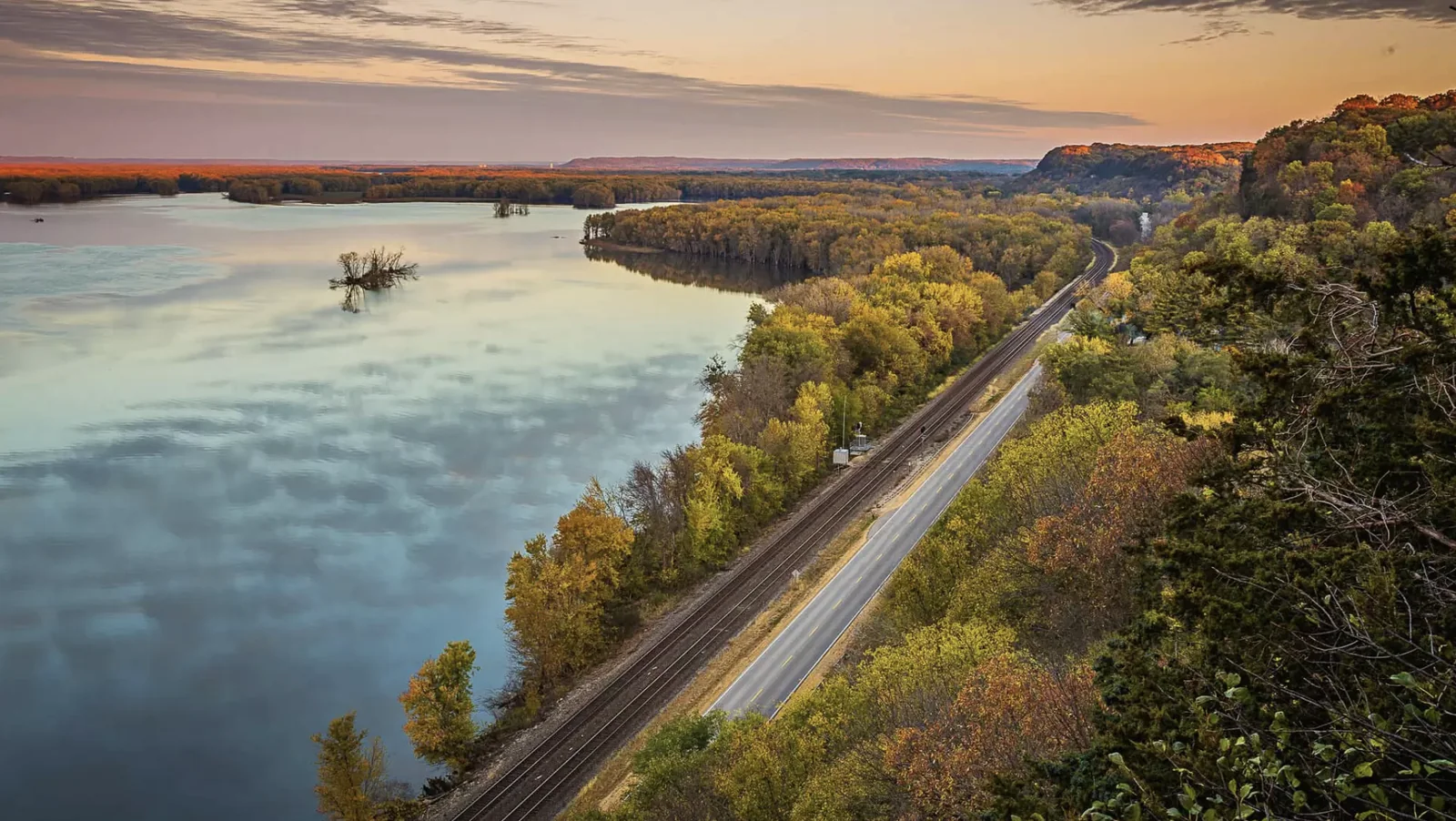
The Great River Road follows the Mississippi for roughly 2,000 miles through 10 states — from Itasca State Park in Minnesota, where the river is narrow enough to wade across, down to New Orleans, where it reaches the Gulf. It isn't one highway but a signed network of river-hugging roads, and the smart way to drive it is to match the season to the section: the northern bluff country in fall, the Deep South in winter. Here's the full route — the day-by-day plan, the daily mileage, the stops worth your time, and the ones to skip.
Headwaters to the Gulf — the whole Mississippi in one drive.
What the Great River Road actually is
The Great River Road is not a single highway — it's a network of state and local roads that hug both banks of the Mississippi, strung together and signed as one National Scenic Byway. It runs the length of the river through 10 states — Minnesota, Wisconsin, Iowa, Illinois, Missouri, Kentucky, Tennessee, Arkansas, Mississippi, and Louisiana — and because it follows the water instead of the interstate, it threads through river towns, past locks and dams, along limestone bluffs, and out across the flat Mississippi Delta.
You navigate it by watching for the green pilot's-wheel signs — a steamboat's wheel on a green shield — which mark the route on both sides of the river. And because it's a network, you're often choosing a bank: in the north the Wisconsin and Minnesota sides trade the best views back and forth, and in the south the Mississippi and Louisiana sides each have their own towns and history. The itinerary below picks the more scenic or more interesting bank at each stretch and tells you when to cross.
Great River Road map
The whole route at a glance — from Lake Itasca in the north woods to the Gulf at New Orleans, with the ten overnight stops in this itinerary.
Open this route in the planner to get a live, zoomable map with turn-by-turn stops, daily driving times, and where-to-stay links you can adjust.
When to go: north in fall, south in winter
The route runs 1,500 miles of latitude, so no single month is best for the whole thing — the trick is to match the season to the section.
Northern section (Minnesota to St. Louis) — late September to late October. This is bluff country, and it turns gold and red in autumn. Lake Pepin, the Great River Bluffs, and the Galena hills peak when the maples change, usually the first three weeks of October. Summer works too, but fall is the reason to drive the north.
Southern section (Memphis to New Orleans) — November to March. The Delta and the Gulf coast are hot and humid from May through September. Come in the cool months and you get comfortable walking weather in Natchez and New Orleans, thinner crowds, and the peak of the live-music calendar leading into Mardi Gras. If you're driving the whole route in one push, aim for mid-October: you'll catch the tail of northern color and reach the Deep South as it cools off.
Direction, rentals, and road conditions
Drive north to south
The classic way is to follow the river's flow, from the trickle at Lake Itasca to the mile-wide river at New Orleans — the trip builds naturally from quiet headwaters to the crescendo of the French Quarter. South to north works and is sometimes cheaper on one-way rentals, but you lose that sense of the river growing beside you.
One-way, not a loop
Because the route is a straight shot rather than a circle, most people fly into Minneapolis, drive south, and fly home from New Orleans. Expect a one-way rental drop fee (often $150–$400) for leaving the car in a different city; factor it in, or drive the interstate back if you'd rather not. Splitting the trip works well too — the northern and southern halves each start and end at a good airport (Minneapolis/St. Louis, and Memphis/New Orleans).
What the roads are like
This is easy driving — paved two-lane and small highways the whole way, no mountain passes. The northern bluff roads wind and climb a little; the southern Delta is dead flat and straight. Gas and cell coverage are reliable in the towns but thin on the rural stretches between them, especially in the Delta between Memphis and Vicksburg, so top up when you can. A few riverside spots use seasonal ferries rather than bridges — check the schedule before you count on a crossing. The daily drive-time caps from our planning guide hold here even though the legs look short: river roads and small-town main streets are slow, and slow is the point.
The 10-day itinerary, day by day
The day legs below sum to about 1,600 miles of point-to-point driving over the river's ~2,000-mile course; the difference is the meander you'll happily add for overlooks and river-town main streets. Mileages are for the scenic route, not the interstate, so build in extra time.
Itasca State Park to Minneapolis
Start where the river does: at Lake Itasca, walk across the line of stepping stones at the Mississippi headwaters, narrow enough to hop the river on foot. Drive south through Minnesota's pine-and-lake country and overnight in Minneapolis, where the Stone Arch Bridge gives you your first big-city river view.
Minneapolis to La Crosse via Red Wing & Winona
The bluffs begin, and this is arguably the prettiest driving day of the whole route. Stop in Red Wing for the pottery, the Barn Bluff climb, and the historic riverfront; roll past Lake Pepin, the widest natural stretch of the Mississippi; and take in the overlooks around Winona. Overnight in La Crosse, Wisconsin, and drive up to Grandad Bluff at sunset for a three-state view.
La Crosse to Dubuque & Galena
Cross into Iowa for Effigy Mounds National Monument, where ancient peoples built animal-shaped earthworks on the bluffs, and take in the view from Pikes Peak State Park. Finish in Galena, Illinois — Ulysses S. Grant's town, with a preserved 19th-century main street; riverside Dubuque is 20 minutes west if you'd rather stay on the water.
Dubuque to the Quad Cities
A short, easy day. Hike the river overlooks at Mississippi Palisades State Park, then watch barges lock through at Lock & Dam 15 in the Quad Cities — the visitor area is the best place to see how the river is engineered. Art lovers should stop at the Figge Art Museum in Davenport.
Quad Cities to Hannibal
Hannibal, Missouri is Mark Twain's boyhood town, and it leans into it well. Tour the Mark Twain Boyhood Home & Museum, go underground at Mark Twain Cave (the one from Tom Sawyer), and take a paddle-wheeler cruise. Overnight in the historic district so you can walk the old streets after the day-trippers leave.
Hannibal to St. Louis
Ride the tram to the top of the Arch at Gateway Arch National Park for the river-and-city view, and see the Westward Expansion museum beneath it. On the way in, detour to the Old Chain of Rocks Bridge, the former Route 66 crossing — the two great American road trips meet here (more on that in our Route 66 guide). Overnight in St. Louis; try toasted ravioli or St. Louis-style barbecue.
St. Louis to Memphis via New Madrid
The longest driving day, and the transition into the South. Break it up at Trail of Tears State Park and at New Madrid, Missouri, epicenter of the enormous 1811–12 earthquakes, where a riverside observation deck explains what happened. By evening you cross into the Delta at Memphis — ribs near Beale Street, with the National Civil Rights Museum saved for the morning.
Memphis to Vicksburg via Clarksdale
This is the blues day. Clarksdale, Mississippi sits at the legendary Crossroads of Highways 61 and 49; visit the Delta Blues Museum and catch live music at a juke joint like Ground Zero. Then cross the flat, wide-open Delta to Vicksburg and its sprawling National Military Park above the river.
Vicksburg to Baton Rouge via Natchez
Natchez, Mississippi is the oldest town on the river and one of the prettiest — bluff-top views, historic architecture, and the northern end of the Natchez Trace. Have lunch on the bluff, then cross the river bridge into Louisiana and continue to Baton Rouge for the night.
Baton Rouge to New Orleans via the River Road
The final stretch runs the River Road plantation corridor between Baton Rouge and New Orleans. For an honest account of this landscape's history, tour the Whitney Plantation — the one museum here built to center the lives of the enslaved people who worked the land, rather than the mansion architecture. Then arrive in New Orleans: the French Quarter, the river walk at Woldenberg Park, and beignets at Café du Monde. It's the right note to end 2,000 miles of river on.
Not driving all 10 days?
Shorten it, flip the direction, add nights in the towns you care about, or split it into a northern-fall and southern-winter trip. Open this exact route in the planner and adjust the days, stops, and budget to your dates.
Customize the Great River Road route →15 best stops on the Great River Road
If you can't do the full drive, these are the stops worth building a trip around, north to south.
- Mississippi headwaters, Lake Itasca (MN) — where the river begins, a shallow outlet you can walk across. The symbolic start of the whole route.
- Red Wing (MN) — bluffs, pottery, and a walkable riverfront; climb Barn Bluff for the view down Lake Pepin.
- Lake Pepin (MN/WI) — the river's widest natural lake, ringed by bluffs, and the prettiest slow-driving stretch in the north.
- Effigy Mounds National Monument (IA) — ancient animal-shaped earthworks on the bluffs, a moving and uncrowded stop.
- Galena (IL) — a preserved 19th-century town and Ulysses S. Grant's home, tucked into the hills just off the river.
- Mississippi Palisades State Park (IL) — cliffs, hiking, and overlooks near the Iowa border.
- Lock & Dam 15, Quad Cities (IA/IL) — watch barges rise and fall through the locks; the clearest look at how the river is engineered.
- Hannibal (MO) — Mark Twain's boyhood town: the museum, the cave from Tom Sawyer, and a paddle-wheeler.
- Gateway Arch National Park (MO) — ride to the top for the classic river-and-city panorama; the underground museum is excellent.
- New Madrid (MO) — epicenter of the 1811–12 earthquakes that briefly ran the Mississippi backward; a quiet riverside stop with a big story.
- Memphis (TN) — Beale Street music, world-class barbecue, and the National Civil Rights Museum at the Lorraine Motel.
- Clarksdale (MS) — the Crossroads of the blues: the Delta Blues Museum, juke joints, and Highway 61 running dead straight through the cotton.
- Vicksburg National Military Park (MS) — a vast, walkable Civil War battlefield on the bluffs above the river.
- Natchez (MS) — the oldest town on the river: bluff-top overlooks, historic architecture, and the head of the Natchez Trace.
- Whitney Plantation & the River Road (LA) — the plantation museum that tells the history of slavery honestly, on the road into New Orleans.
Northern vs southern section: which is better?
Short answer: drive the north for scenery and the south for culture and food. If you can only do one half, let the season decide — the north in fall, the south in winter.
| Northern (MN → St. Louis) | Southern (Memphis → New Orleans) | |
|---|---|---|
| Best for | Scenery: bluffs, river lakes, fall color | Culture: blues, food, river & Civil War history |
| Signature stretch | Red Wing → Dubuque (bluff country) | Clarksdale → Natchez → New Orleans |
| Best season | Late Sept–Oct (foliage) | Nov–Mar (cool, live-music season) |
| Driving feel | Winding river roads and overlooks | Flat, wide-open Delta; straight Highway 61 |
| Don't miss | Lake Pepin, Effigy Mounds, Galena | Memphis, the Delta, Whitney Plantation |
Costs and practical tips
A rough per-person budget for the 10-day drive, based on two people sharing a car and mid-range motels. These are planning estimates, not live prices — check current fuel and lodging before you book.
| Item | Estimate | Notes |
|---|---|---|
| Fuel | $220–$280 (whole car) | ~2,000 mi at ~28 MPG ≈ 71 gallons; scenic detours add 10–15%. |
| Lodging | $110–$180 / night | Mid-range motels and river-town inns; New Orleans and fall-weekend Galena run higher. |
| Food | $45–$70 / person / day | Cheaper in the Midwest, worth a splurge in Memphis and New Orleans. |
| Attractions | $120–$200 / person total | Arch tram, museums, plantation and blues-museum tickets. |
| 10-day total | ~$1,600–$2,400 / person | Two sharing a car; less if you camp, more with a rental. |
Practical tips
- Follow the pilot's wheel, not just your GPS. Navigation apps default to the interstate; the green signs keep you on the scenic river route.
- Pick your bank. In the north the Wisconsin and Minnesota sides trade the best views — cross at the bridges. In the south the east bank has most of the towns.
- Book the big-ticket stops ahead. The Arch tram, Whitney Plantation tours, and fall weekends in Galena and Red Wing sell out.
- Driving an EV? Fast charging is easy in the cities; plan a buffer through the rural northern bluffs and the Delta between Memphis and Vicksburg, and charge in town rather than counting on roadside stalls.
Great River Road FAQ
How many days do you need to drive the Great River Road?
Plan for 10 days to drive the full 2,000-mile route comfortably. You can do it in 7 at a fast pace, or split it into a 5-day northern segment (Minnesota to St. Louis) and a 5-day southern segment (St. Louis to New Orleans). Two weeks lets you slow down for state parks, blues clubs, and river towns.
What states does the Great River Road go through?
Ten, following the river north to south: Minnesota, Wisconsin, Iowa, Illinois, Missouri, Kentucky, Tennessee, Arkansas, Mississippi, and Louisiana.
Is the Great River Road worth driving?
Yes, if you like variety over a single dramatic landscape. The northern bluff country between Red Wing and Dubuque rivals any river drive in the country, and the southern Delta from Memphis to New Orleans is the heart of American blues and food history. It's also less crowded than the coastal highways and cheap to drive.
What is the best part of the Great River Road?
For scenery, the northern stretch from Red Wing to Dubuque — bluffs, Lake Pepin, and river overlooks. For culture and food, the southern stretch from Memphis through Clarksdale, Vicksburg, and Natchez to New Orleans. If you can only drive one half, pick the north in fall or the south in winter.
Great River Road vs Route 66: which should you drive?
Route 66 is a west-bound nostalgia drive across the desert Southwest; the Great River Road is a north-south river drive through green bluff country and the Deep South. Choose Route 66 for retro Americana and open landscapes, the Great River Road for water views, small river towns, blues, and Southern food. Fittingly, the two cross in St. Louis.
Can you drive the Great River Road in an EV?
Yes. Fast charging is easy along the cities of the route — Minneapolis, the Quad Cities, St. Louis, Memphis, Baton Rouge, and New Orleans all have DC fast chargers. The gaps to plan for are the rural northern bluffs and the Delta between Memphis and Vicksburg: arrive with a comfortable buffer and charge in town rather than counting on roadside stalls.
Turning this into your Great River Road trip
The Great River Road rewards a simple planning order: decide which half (or the whole thing), match your dates to the season — north for fall color, south for the cool months — then pick the two or three river towns you refuse to rush and let the rest of the days flex around them. Then follow the green pilot's wheel from the headwaters to the Gulf.
Plan your own Great River Road trip
Turn this itinerary into a personalized plan — your dates, your pace, your car — with a live map, daily driving times, weather, fuel or charging estimates, and where-to-stay links.
Open the Great River Road planner →