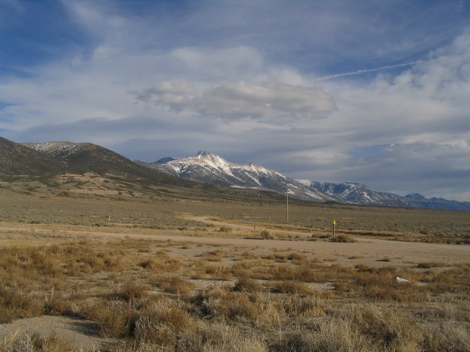
US 50 across Nevada earned its nickname the hard way: in 1986, Life magazine called the state's stretch "The Loneliest Road in America" and warned drivers not to attempt it without survival skills. Nevada leaned in — printing a tongue-in-cheek "Highway 50 Survival Guide" and a passport you get stamped in the towns along the way. The road is very drivable, but the nickname isn't wrong about the emptiness: roughly 400 miles of Basin and Range between Fallon and the Utah line, long straightaways over one mountain pass after another, a handful of tiny mining and Pony Express towns, and some of the darkest night skies left in the country. Here's the full route west to east — the honest pacing, where to fill the tank, the stops worth your time, and how to plan fuel and lodging across the gaps.
400 empty miles of Basin and Range — mining towns, Pony Express ghosts, and the darkest skies in America.
What the Loneliest Road actually is
The "Loneliest Road in America" is the Nevada section of US Route 50, a transcontinental highway that runs coast to coast; the nickname belongs to the roughly 400 miles between Fallon in the west and the Utah border at Great Basin National Park in the east. The label came from a 1986 Life magazine piece that called the drive lonely and cautioned that travelers needed "survival skills" to attempt it. Rather than fight the bad press, Nevada turned it into a mascot — which is why you'll find an official Highway 50 Survival Guide and a stamp-collecting passport waiting at the western end.
Geographically it's a tour of the Basin and Range: the road runs dead straight across a wide sagebrush valley, climbs over a mountain pass, drops into the next valley, and repeats for the whole width of the state. That empty corridor is layered with history — this is roughly the path of both the Pony Express and the old Lincoln Highway, America's first transcontinental auto road — so the "nothing out here" stretches are dotted with station ruins, ghost-town mines, and hillside silver towns that never quite emptied out. The passport gimmick turns the emptiness into a game: collect stamps in the towns, mail the guide back, and Nevada sends you an "I Survived the Loneliest Road" certificate.
Loneliest Road map
The Nevada stretch at a glance — Fallon east to Great Basin National Park.
When to go
The season here is set by the high country at the eastern end, not by the desert valleys. Aim for late spring through fall, roughly May into October, when Great Basin National Park and the road up Wheeler Peak are clear of snow. In winter the park's high elevations hold snow well into spring and the Wheeler Peak Scenic Drive closes, so a cold-weather trip means skipping the finale that makes the whole drive worth it.
Summer is the reliable window: valley days get hot, but the elevation means nights cool off fast, which is perfect for stargazing. Late spring and early fall are the sweet spots — milder days, thinner crowds, and sometimes a dusting of snow on the peaks above green valleys. Whenever you go, check road and park conditions before you commit to a day: mountain weather at Great Basin changes quickly, and an afternoon thunderstorm or an early snow can rearrange your plans up high.
Direction, pacing, and logistics
Drive west to east
Go Fallon to Great Basin. The landscape builds the right way — you start on the flats near Reno and finish climbing into an alpine national park, so the drive crescendos instead of fizzling out, and it puts the trip's best experience, the dark-sky night under Wheeler Peak, at the very end. You can drive it east to west if the Utah parks are your starting point; the stops are the same, reversed.
How long it honestly takes
You can drive the pavement in two hard days, but three is the comfortable pace and four lets Great Basin have the full day and night it deserves. The mileage is modest — around 400 miles — but the towns are spaced far enough apart that you'll want to break the driving into legs that each end somewhere with a bed and a gas pump. Treat the drive times below as planning estimates, not live conditions.
The empty stretches, and fuel
This is the one genuine planning concern, and it's the whole personality of the road: services are far apart. There are long gaps between towns with no fuel, no food, and thin or no cell coverage, so the rule is simple — fill up in every town and never leave one below half a tank. Carry water and offline maps, and don't count on a station being open late. The daily drive-time caps in our planning guide matter here even though the days look short: straight desert highway is deceptively tiring, and you want to reach each town with daylight to spare.
The Loneliest Road itinerary, day by day
Here's the drive west to east in five short legs, paced so each night lands in a town with lodging and fuel — with the last day given over entirely to Great Basin. You can compress the driving into two or three days if you're short on time; this version spreads it out so nothing feels rushed. Mileages are approximate for the US 50 routing, and every leg assumes you top off the tank before you pull out of town.
Fallon to Austin
Fallon is the last real supply town before the emptiness, so start here: grab the free Highway 50 Survival Guide and passport, gas up, and buy water. Heading east, pull off at Grimes Point to walk among basalt boulders covered in petroglyphs thousands of years old, then watch for Sand Mountain — a 600-foot dune that actually hums, or "sings," when the sand slides down its face. Farther on, the Cold Springs and Middlegate area marks old Pony Express station sites, and you'll pass the strange Middlegate shoe tree, a lone cottonwood hung with hundreds of pairs of tied-together shoes. Climb the first of many passes and drop into Austin, a silver-boom town stacked up a canyon wall, for the night.
Austin to Eureka
Give Austin a slow morning. Founded on an 1860s silver strike, it clings to the side of the Toiyabe Range with weathered churches, old storefronts, and a short drive up to Stokes Castle — a three-story stone tower a mining baron built in 1897, now a lonely ruin with a huge view down the valley. Then comes one of the emptiest legs of the whole road: a long, straight run over Bob Scott Summit and across broad sagebrush basins to Eureka. Billed as "the friendliest town on the loneliest road," it has a remarkably intact main street and a restored 1880 opera house you can tour.
Eureka to Ely
Another wide-open stretch delivers you to Ely, the largest town on the eastern half and your best base for the night. Its headline attraction is the Nevada Northern Railway, a preserved short-line where you can ride behind a vintage steam locomotive and tour the old shops and rail yard. Downtown, hunt for the large-scale murals painted across building walls, and if you have daylight to spare, drive out to the Ward Charcoal Ovens — six beehive-shaped stone kilns built in the 1870s to fuel the smelters, standing improbably intact in the pinyon-and-juniper foothills.
Ely to Great Basin National Park & Baker
Leave Ely and cross the last basins to the Utah line, where the Snake Range rises abruptly to 13,065-foot Wheeler Peak — the payoff of the whole drive. The tiny gateway hamlet of Baker sits just outside Great Basin National Park and is the closest bed to the entrance, so settle in there. Your first park stop is Lehman Caves, a richly decorated marble cavern you can only enter on a ranger-led tour, so plan to reserve a spot rather than count on a walk-up. Spend what's left of the day getting oriented at the visitor center and resting your eyes for what comes after dark.
Great Basin: Wheeler Peak and the dark-sky finale
This is why you came the long way. Drive the Wheeler Peak Scenic Drive as it switchbacks to nearly 10,000 feet, then hike to the ancient bristlecone pine grove — some of these gnarled, wind-scoured trees are among the oldest living things on Earth — with glacier and summit trails climbing higher if you're acclimated to the altitude. After sunset, Great Basin becomes one of the darkest places in the country: as an International Dark Sky Park it delivers a Milky Way bright enough to throw a faint shadow, with ranger-led astronomy programs in season. Before you leave, collect your passport's last stamps and mail the guide in for the "I Survived the Loneliest Road" certificate.
Only have a couple of days?
The Loneliest Road compresses well. Drive Fallon to Ely in two days for the mining towns and Pony Express history, or push straight through to Baker and give all your time to Great Basin's caves, peaks, and dark skies. Build either version — your dates, your pace, your fuel stops — in the planner.
Plan your Loneliest Road trip →12 best stops on the Loneliest Road
If you can't drive the whole thing, these are the stops worth building a trip around, west to east.
- Fallon (NV) — the start and last full-service town; pick up the Survival Guide and passport, gas up, and stock water.
- Grimes Point (NV) — an accessible field of basalt boulders carved with ancient petroglyphs, just east of Fallon.
- Sand Mountain Recreation Area (NV) — a 600-foot "singing" sand dune that hums when the sand slides, right off the highway.
- Cold Springs & Middlegate (NV) — Pony Express station sites and the quirky Middlegate shoe tree hung with hundreds of pairs.
- Austin (NV) — a silver-mining town stacked up a canyon wall, with Stokes Castle above the valley.
- Eureka (NV) — "the friendliest town on the loneliest road," with an intact main street and a restored 1880 opera house.
- Ely (NV) — the biggest town on the eastern half; downtown murals and the best lodging on the route.
- Nevada Northern Railway, Ely (NV) — heritage steam-train rides and a preserved rail yard and shops.
- Ward Charcoal Ovens State Historic Park (NV) — six beehive-shaped 1870s stone kilns standing intact in the foothills.
- Great Basin National Park (NV) — Lehman Caves, 13,065-foot Wheeler Peak, and groves of ancient bristlecone pines.
- Wheeler Peak Scenic Drive (NV) — climbs to nearly 10,000 feet for alpine trails, bristlecones, and glacier views.
- Great Basin's dark skies (NV) — an International Dark Sky Park with some of the clearest Milky Way viewing in the country.
Town by town: distances and what's there
Because services are so far apart, the most useful thing to know here isn't a "vs" table — it's exactly how far the next town is and what you'll find when you get there. Use this to plan fuel and where to sleep; miles are approximate for the US 50 routing.
| Town | Approx. miles to next stop | Fuel / food / lodging | Why stop |
|---|---|---|---|
| Fallon | ~110 mi to Austin | Full services — last supermarket | Survival Guide & passport; gas up and stock water |
| Austin | ~70 mi to Eureka | Fuel, a few cafes and small inns | Hillside silver town; Stokes Castle |
| Eureka | ~80 mi to Ely | Fuel, food, small hotels | "Friendliest town"; the 1880 opera house |
| Ely | ~65 mi to Baker | Full services; most rooms on the route | Nevada Northern Railway; Ward Charcoal Ovens |
| Baker | Park gateway (route's end) | Very limited — plan ahead | Great Basin gateway; the darkest skies |
| Great Basin NP | — | No fuel; campgrounds in the park | Lehman Caves, Wheeler Peak, bristlecones, stars |
Read that table and the appeal is obvious: this is an old-highway drive strung between small towns that never fully faded, which scratches the same nostalgic itch as Route 66 — minus the crowds and the neon. The trade is that you carry your own margin for fuel and food, which is exactly what the "survival" framing is winking at.
Costs and practical tips
A rough per-person budget for a 3-day drive, based on two people sharing a car and small-town motels. These are planning estimates, not live prices — check current fuel and lodging before you book, and never treat any number here as a live quote.
| Item | Estimate | Notes |
|---|---|---|
| Fuel | $70–$110 (whole car) | ~400 mi plus detours at ~25 MPG; fill up in every town. |
| Lodging | $90–$160 / night | Small-town motels; Ely has the most rooms, Baker the fewest. |
| Food | $35–$55 / person / day | Diners and cafes with limited hours; carry snacks and water. |
| Attractions | $40–$90 / person total | Lehman Caves tour, Nevada Northern Railway, small museums. |
| 3-day total | ~$300–$500 / person | Two sharing a car; less if you camp at Great Basin. |
Practical tips
- Fill up in the towns. Fuel is far apart — top off in Fallon, Austin, Eureka, and Ely, and never leave a town below half a tank.
- Get the passport stamped. Pick up the Highway 50 Survival Guide in Fallon, collect stamps in the towns as you go, then mail it in for the "I Survived" certificate.
- Pack for high desert. Great Basin is high-elevation with fast-changing weather; carry layers, extra water, and a full tank even in summer.
- Come for the stars, not the aurora. The night show here is the Milky Way; true northern lights this far south are rare, so plan your dark-sky night around a new moon and a clear forecast.
Loneliest Road FAQ
Why is US 50 called the Loneliest Road in America?
The nickname comes from a 1986 Life magazine article that described the Nevada stretch of US 50 as lonely and warned that drivers needed "survival skills" to attempt it. Nevada embraced the label and now markets the route with an official Highway 50 Survival Guide and a stamp-collecting passport. The name fits the emptiness: about 400 miles of Basin and Range with long gaps between small towns.
How many days do you need to drive the Loneliest Road?
Two days is the minimum for the ~400-mile Nevada section, three is comfortable, and four lets Great Basin National Park have a full day and night. Most of the mileage is quick desert highway, but the towns are spaced far apart, so plan each leg to end somewhere with lodging and fuel — Austin, Eureka, Ely, and Baker are the natural overnights west to east.
Is the Loneliest Road safe to drive, and where do you get gas?
It's a paved, well-signed federal highway and perfectly safe to drive — the real concern is distance between services, not danger. Fuel, food, and cell coverage are reliable in the towns but sparse between them, so fill up in Fallon, Austin, Eureka, and Ely, keep the tank above half, and carry water and offline maps. Baker and Great Basin have very limited services, so arrive with a full tank.
What is the Highway 50 "Survivor" passport?
It's Nevada's playful take on the nickname: a passport you pick up with the free Highway 50 Survival Guide, then get stamped in the towns along the route. Collect the stamps, mail the completed guide back to the state tourism office, and they send you an "I Survived the Loneliest Road in America" certificate — a fun reason to actually stop in each town rather than blow through.
When is the best time to drive it?
Late spring through fall, roughly May into October, when Great Basin National Park and the Wheeler Peak Scenic Drive are clear of snow. Summer valley days get hot but nights cool off fast, which is ideal for stargazing; late spring and early fall bring milder weather and thinner crowds. Avoid winter for the full experience, when the park's high country holds snow and the peak road closes.
Can you really see the Milky Way at Great Basin National Park?
Yes — Great Basin is an International Dark Sky Park and one of the darkest, driest places in the country, so on a clear, moonless night the Milky Way is bright enough to be startling, and rangers run astronomy programs in season. Just don't expect the northern lights: this far south a true aurora is rare, so the show to plan for is the stars and the Milky Way, best around a new moon.
Turning this into your Loneliest Road trip
The Loneliest Road rewards a simple plan: pick a window between late spring and fall, decide whether you're doing the full drive or just Fallon-to-Ely, and lock a room in Baker or Ely first because those are the scarcest beds. Build the days so each one ends in a real town with a gas pump, and save a clear, moonless night for Great Basin. Because the route finishes right at the Utah line, it also pairs naturally with a trip east into Utah's national parks. Fill the tank, grab the passport, and point the car east across the emptiest, starriest highway in the country.
Plan your own Loneliest Road trip
Turn this itinerary into a personalized plan — your dates, your pace, your car — with a live map, daily driving times, weather, fuel estimates, and where-to-stay links across the empty stretches.
Open the planner →