An Oregon Coast road trip is the rare famous drive that over-delivers. US 101 runs about 363 miles from Astoria to Brookings — the Pacific Coast Scenic Byway — past sea stacks, working fishing ports, a Sahara's worth of dunes, and headland after headland of free public beach, because in Oregon every inch of ocean shore belongs to the public by law. It's the wilder, cheaper, less-trafficked sibling of California's Highway 1, and it rewards a different kind of trip: slower, foggier, more layered-up. Here's how the route breaks into three acts, when to go (September, mostly), how many days the full run honestly needs, and the 2026 slide repairs and parking-permit changes worth knowing before you point the car west.
The short version: an Oregon Coast road trip covers about 363 miles of US 101 from Astoria to Brookings, drives best north to south with the ocean on your right, needs five days to do properly, and peaks in September — after the summer crowds, before the winter storms.
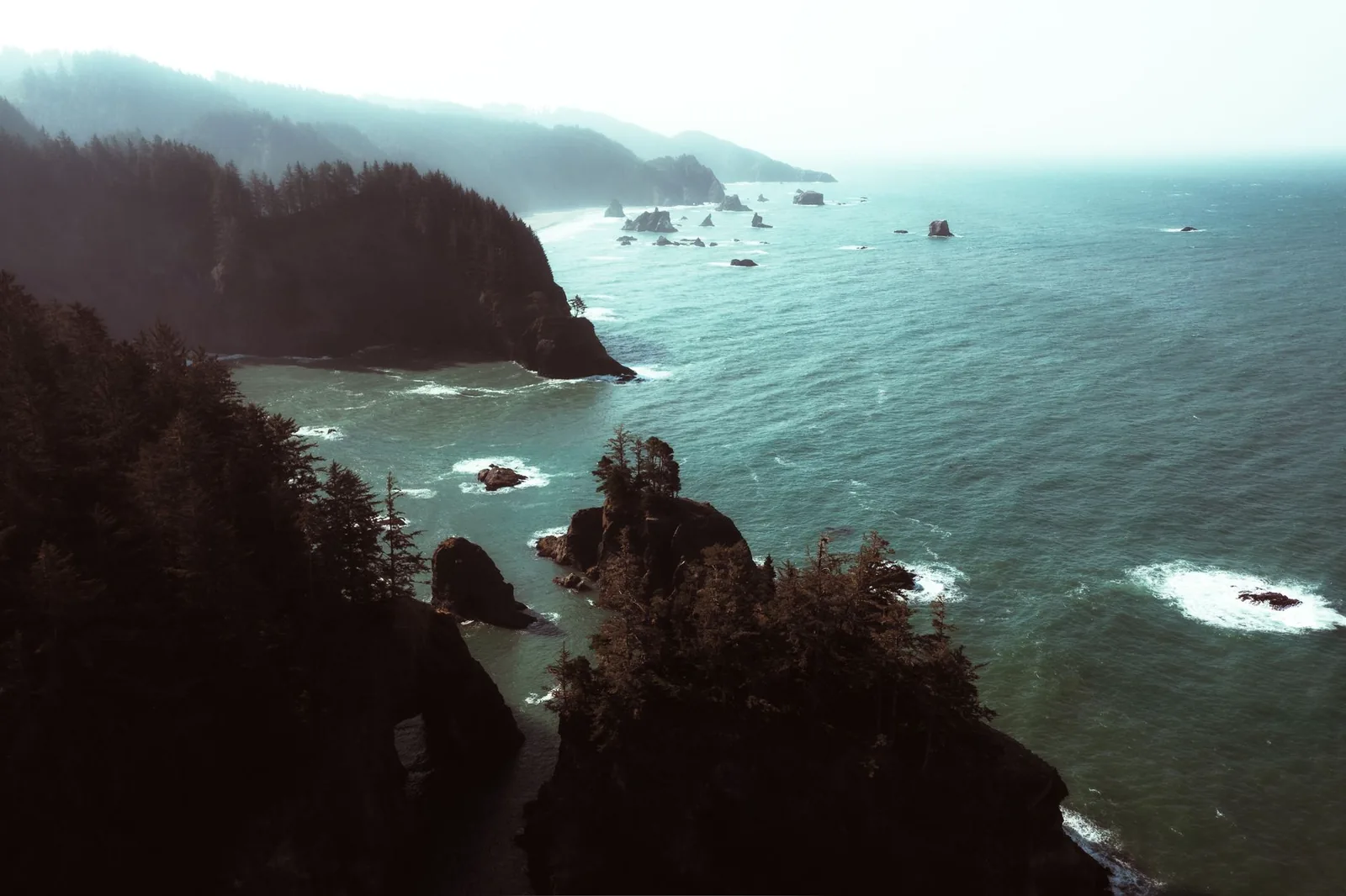
US 101 in Oregon, in four decisions
- Drive north to south, and give it five days — southbound puts the ocean on your right for every pullout, and the full 363 miles as a weekend is the classic mistake.
- Aim for September — summer brings crowds and afternoon fog, winter brings storms worth watching; early fall keeps the light and loses the lines.
- Don't skip the south coast — most visitors turn around near Newport, which is exactly why the Samuel H. Boardman corridor is the best-kept open secret on the route.
- Budget for parking permits and check TripCheck — more state parks charge day-use parking in 2026, and the south coast has active landslide-repair zones. Check TripCheck before you drive.
What the Oregon Coast Highway actually is
US 101 hugs the Oregon shore for about 363 signed miles, and the whole run — Astoria to Brookings — is designated the Pacific Coast Scenic Byway. Two facts set it apart from every other coastal drive in the country. First, the 1967 Beach Bill: Oregon's ocean beaches are publicly owned, all of them, so there is no private-sand problem and no gate between the highway and the water. Second, density — the state parks, waysides, and viewpoints come every few miles, most of them free, many of them the kind of stop that would headline a lesser coastline.
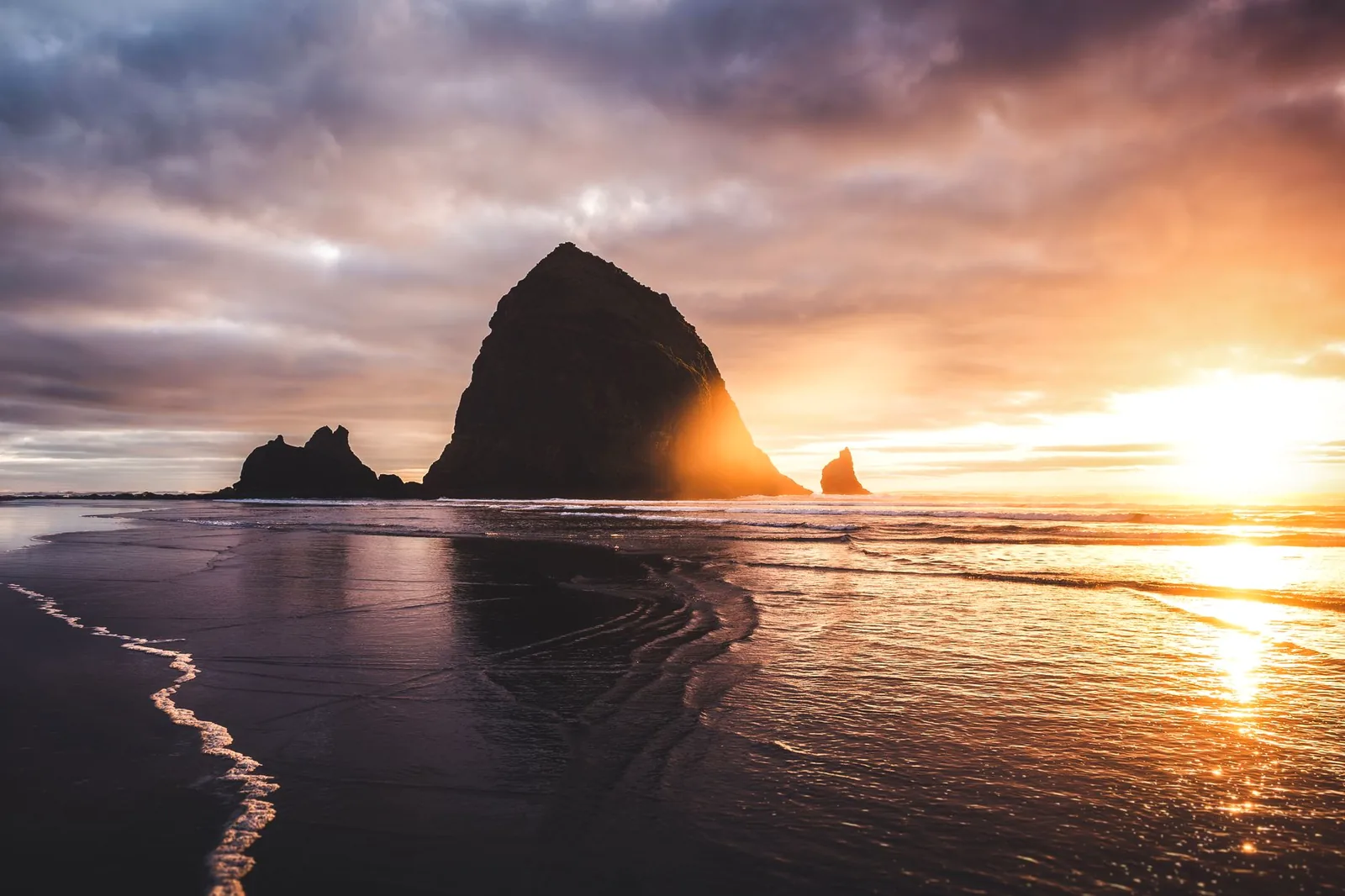
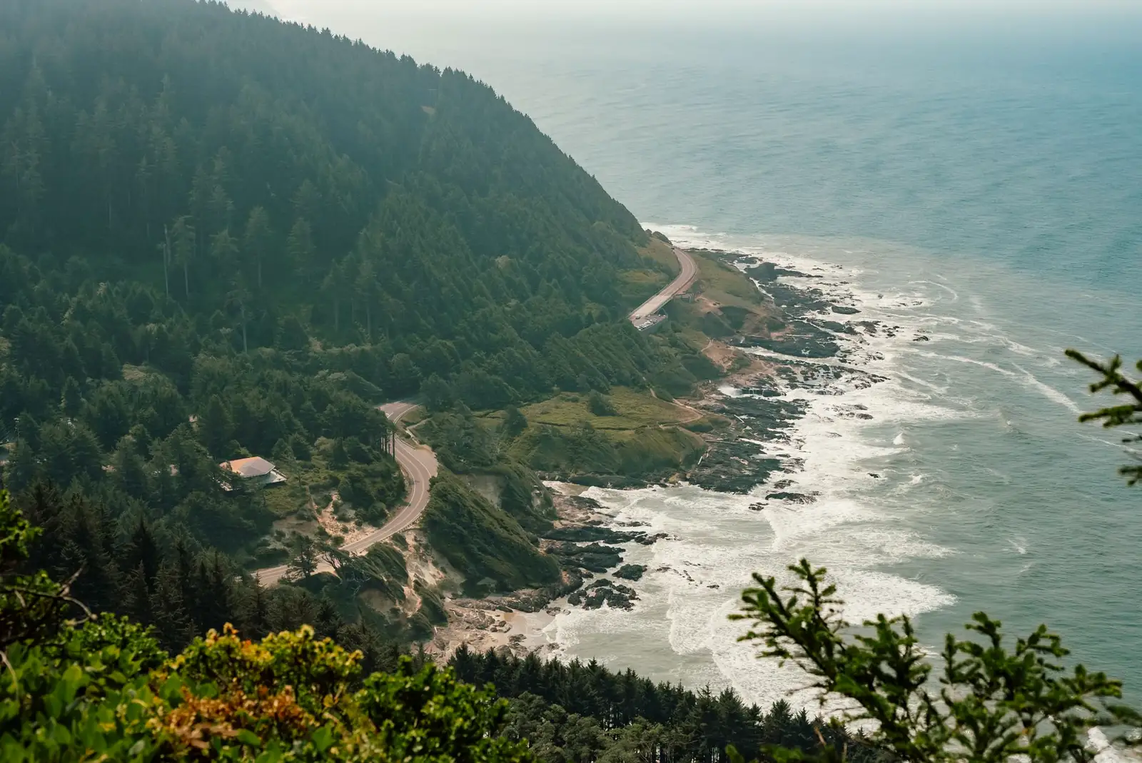
The character is distinct from California's Highway 1 through Big Sur, and it's worth being honest about the difference. Big Sur is a cliff-edge drama drive; the Oregon coast is a working coast — fishing fleets, cheese factories, cranberry bogs, lighthouses that still earn their keep — with the drama arriving in punctuation marks: Haystack Rock, Cape Perpetua, the Boardman corridor. It's also colder than most first-timers expect. This is a 55-and-windy coastline in July, a hoodie-and-rain-shell trip in any month, and better for it: the fog and the moody light are the aesthetic, not the flaw.
The route, north to south: three acts in 363 miles
An Oregon Coast road trip sorts itself into three sections with genuinely different personalities, and — unlike most famous drives — the emptiest act is arguably the best:
| Section | Character | Don't-miss stops |
|---|---|---|
| North Coast — Astoria to Pacific City (~100 mi) | The postcard act: the busiest towns, the most famous rock, and the shortest drives from Portland | Astoria's riverfront and column, Cannon Beach and Haystack Rock, Ecola State Park, Oswald West State Park and Neahkahnie Mountain, Tillamook Creamery, the Three Capes Scenic Route to Cape Kiwanda |
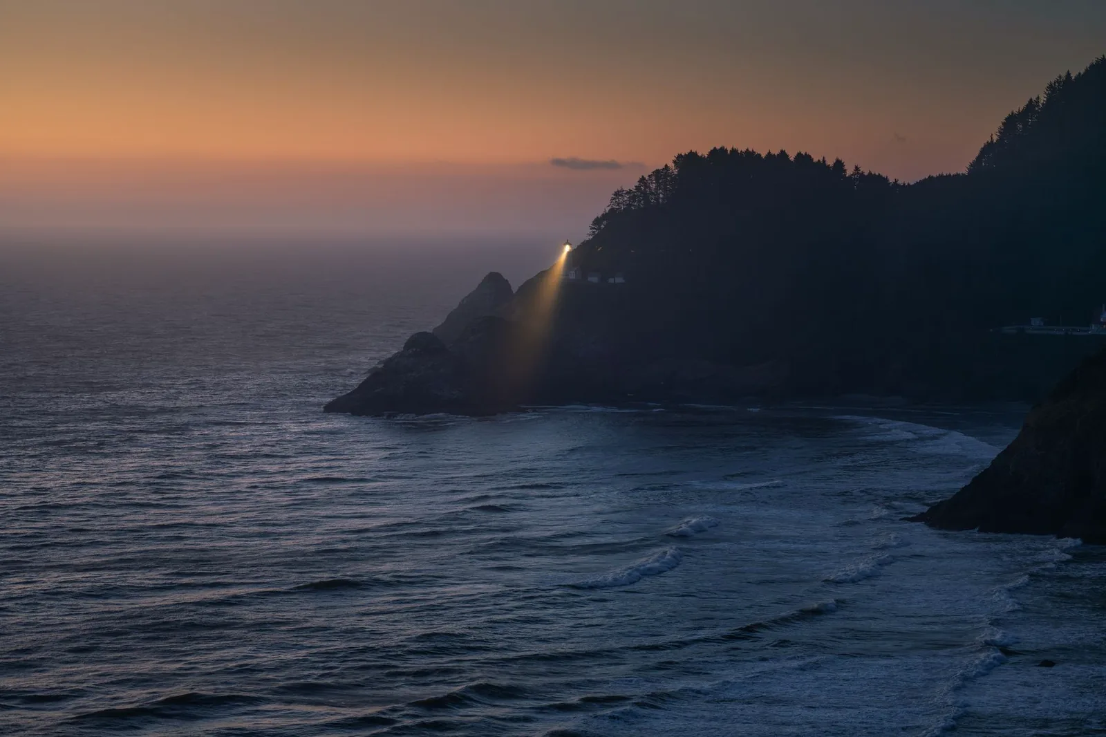
| Central Coast — Lincoln City to Florence (~90 mi) | The lighthouse-and-headland act: whale towns, the coast's best short hikes, and the start of the dunes | Depoe Bay's whale-watching seawall, Yaquina Head Lighthouse, Newport's bayfront, Yachats, Cape Perpetua (Thor's Well, Devil's Churn), Heceta Head Lighthouse viewpoint, Sea Lion Caves, Florence's Old Town |
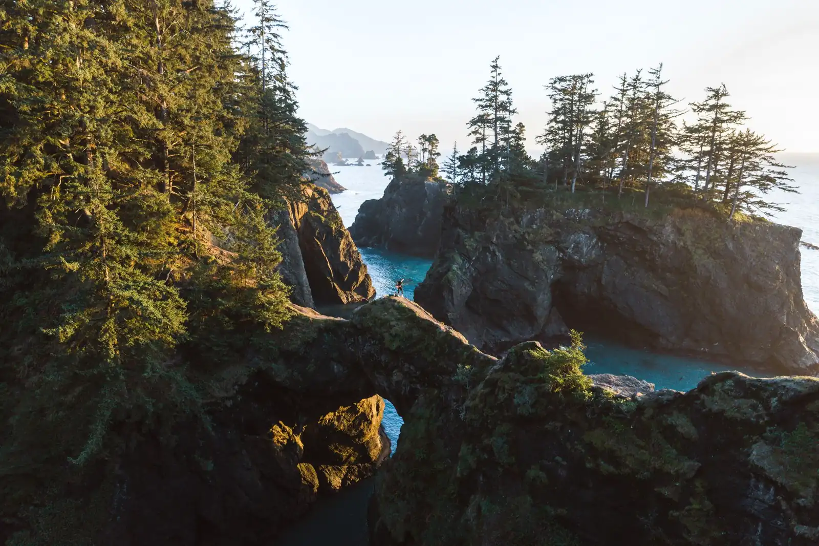
| South Coast — Reedsport to Brookings (~130 mi) | The empty act: the biggest scenery and the fewest people, hours from any interstate | Oregon Dunes National Recreation Area, Shore Acres State Park and Cape Arago, Bandon's Face Rock and Old Town, Port Orford's cliff-top harbor, Humbug Mountain, the Samuel H. Boardman State Scenic Corridor |
The Three Capes Scenic Route: the detour that beats the highway
Between Tillamook and Pacific City, US 101 swings inland through dairy country, and the coast-hugging alternative — the Three Capes Scenic Route past Cape Meares, Cape Lookout, and Cape Kiwanda — is the better road. It's slower and narrower, which is the point: an old-growth-flanked lighthouse at Cape Meares, one of the coast's best headland hikes at Cape Lookout, and the giant climbable dune and haystack rock at Pacific City. If you take one marked detour on the whole trip, take this one.
The Samuel H. Boardman corridor: save appetite for the finale
The last act before Brookings is the roughly 12-mile Samuel H. Boardman State Scenic Corridor, where the highway runs through a near-continuous strip of sea stacks, natural bridges, hidden coves, and viewpoint pullouts — Arch Rock, Natural Bridges, Whaleshead Beach, and more, each a few minutes' walk from the car. Because it sits about as far from a major airport as the Lower 48 coast gets, it stays quiet even in August. Travelers who turn around at Newport never see it; that's the strongest argument for committing to the full route.
When to drive the Oregon coast
September is the best month for an Oregon Coast road trip. July and August bring the warmest weather and the biggest crowds — plus a mechanism first-timers don't expect: strong afternoon north winds and marine fog that can erase the views precisely when inland Oregon is baking, the coast's version of the June-gloom pattern Californians know. Early fall keeps the clear mornings and long light, drops the wind, and empties the campgrounds after Labor Day. It's the coast at its most cooperative.
The other seasons are tradeoffs rather than write-offs. Winter is storm-watching season — a legitimate local tradition, best done from a rented oceanfront room or the glassed-in viewpoints at Shore Acres near Coos Bay — and it's also gray-whale migration season, with the southbound run around late December and the northbound run in spring. Depoe Bay, which bills itself as the whale-watching capital of the coast, has a seawall promenade and a state-run whale watching center right on the highway, and summer visitors regularly spot the resident grays that feed just offshore. Spring is green, cheap, and squally; pack for rain and you'll have headlands to yourself.
One rhythm worth planning around in any season: mornings are the coast's best hours. Wind and fog both tend to build through the afternoon, so structure days as early beach-and-headland time, afternoon driving, and you'll beat both the weather and the parking-lot crush at the famous stops.
How many days an Oregon Coast road trip needs
Five days is the sweet spot for the full Astoria-to-Brookings run, and north to south is the right direction: the ocean rides on your right the whole way, every viewpoint pullout is a right turn instead of a left across traffic, and the scenery crescendos toward the Boardman corridor instead of leading with it. Astoria sits about two hours from Portland, which makes the logistics easy at the top; the bottom is the catch, because Brookings is a long way from everywhere — plan your exit through southern Oregon's US 199 toward I-5 (or continue into the redwoods) rather than pretending the return is a quick hop.
| Plan | What it buys |
|---|---|
| Three days | The compressed version: one night on the north coast, one central. Honest only if you accept a turnaround around Florence — the classic Portland loop, not the full byway |
| Five days | The real trip: roughly a day per act plus slack — a Three Capes morning, a Cape Perpetua afternoon, a dunes stop, a Bandon sunset, and the Boardman corridor without a clock running |
| Seven days | The full-fat version: adds a layover day (Yachats and Bandon are the best bases), a real hike or two, a Depoe Bay whale-watching charter, and fog insurance — a spare day means a socked-in viewpoint gets a second chance |
Pacing math that surprises people: 363 miles sounds like one long day, and as pure driving it's 10 hours or so. But this route has a stop every few miles that deserves 20 minutes, and the famous ones deserve two hours. Budget 60–80 driving-miles a day and let the waysides do their job.
Slide repairs, parking permits, and the practical layer
2026 roadwork: the south coast is patching landslides
Two active landslide repairs meet an Oregon Coast road trip on US 101's southern miles in 2026: per ODOT's southwest Oregon construction report for late July 2026, the Arizona landslide repair about 12 miles south of Port Orford (MP 312) runs into January 2027, and the 80 Acres slide repair south of Gold Beach (MP 332.5) brings intermittent lane closures through the end of September, alongside smaller flagger-controlled safety projects between Coos Bay and Brookings. These are delays, not blockages — the south coast's cliffs move, and schedules shift weekly — so check TripCheck, ODOT's live road-conditions map, the morning you drive the southern act.
State-park storm damage: check before you build a day around it
Winter storms also rearrange the parks themselves. Ecola State Park — the headland forest and viewpoints just north of Cannon Beach — spent early 2026 closed after a December landslide cracked its access road, and while the park reopened in spring, the west section of its Clatsop Loop Trail remains closed under an April 2026 landslide notice. The habit to build: glance at the park's page on the Oregon State Parks site for current notices before committing a morning, at Ecola or any storm-battered wayside.
Parking permits and camping: the fee layer grew in 2026
Most Oregon coast stops are still free, but the paid tier is expanding: per Oregon State Parks' day-use parking page, permits run $10 a day for Oregon-plated vehicles and $12 for out-of-state, with 12-month permits at $60 resident / $75 non-resident — and twenty-two additional parks began requiring permits on March 30, 2026. On a multi-day trip with several paid stops, the annual permit pays for itself quickly. Campers should treat the coast like the contested resource it is: state-park sites release on a rolling six-month window, and summer weekends at the marquee parks go fast — the booking-early logic from our road-trip planning guide applies in full. One consolation: camping includes day-use parking, and Oregon has no sales tax, which quietly discounts the whole trip.
Fuel, fog, and the two-lane reality
Fuel is easy — towns come frequently, and since 2023 Oregon allows self-serve statewide, so out-of-staters no longer need to learn the attendant dance. EV drivers will find charging concentrated in the larger towns (Astoria, Lincoln City, Newport, Coos Bay, Brookings); verify the specific chargers you're counting on before the south coast, where gaps between towns stretch longest. The road itself is mostly two lanes with towns as chokepoints — Lincoln City on a summer Saturday is the route's worst traffic — and fog is a driving condition, not just a mood: slow down, lights on, and give the log trucks room.
Oregon Coast road trip FAQ
How long does it take to drive the Oregon coast?
About 10 hours nonstop for the 363 miles of US 101 from Astoria to Brookings — but nonstop misses the point. With stops every few miles that genuinely deserve time, plan five days for the full route, or three days for a north-and-central loop that turns around near Florence.
Which part of the Oregon coast is the most beautiful?
The strongest cases are Cape Perpetua's headland and tidepools on the central coast and the Samuel H. Boardman corridor's sea stacks and natural bridges near Brookings — though ask three Oregonians and you'll get three answers. The south coast overall wins on scenery-per-visitor, because most travelers never get there.
When is the best time for an Oregon Coast road trip?
September: summer's crowds and afternoon fog fade, the light stays long, and campgrounds reopen after the Labor Day exodus. July and August are warmest but busiest and windiest. Winter is storm-watching and whale-migration season — a different, legitimate trip if you book an oceanfront room and embrace the weather.
Is driving the Oregon coast better north to south?
Yes. Southbound keeps the ocean on your right, so every viewpoint and wayside is an easy right-hand pull-off rather than a left across oncoming traffic — and the scenery builds toward the Boardman corridor finale instead of peaking on day one. Start in Astoria, about two hours from Portland, and end in Brookings.
How much does parking cost on an Oregon Coast road trip?
Most Oregon coast stops are free. Where a permit is required, day-use parking runs $10 a day for Oregon-plated vehicles and $12 for out-of-state, with 12-month permits at $60 resident / $75 non-resident — and twenty-two additional parks began requiring permits on March 30, 2026. Camping includes day-use parking.
Turning this into your Oregon Coast road trip
The planning order for an Oregon Coast road trip: pick the window (September if you can), lock the beds or campsites first — coast lodging is small-scale and summer sites contest hard — then leave the days deliberately loose, because this is a route built for pulling over. Write the one-sentence framework — dates, days, party, budget — and sketch the drive in the planner with the highway itself as the destination. And if the coast bug bites, the continuation writes itself: Brookings sits minutes from the California line and the redwoods, and from there Highway 1 through Big Sur is waiting to finish what 101 started.