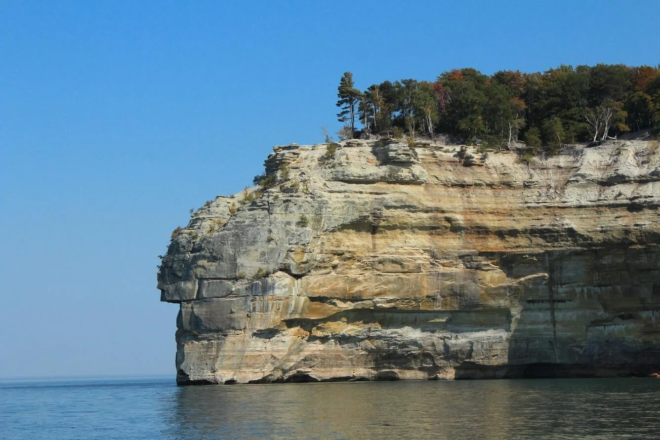
The Lake Superior Circle Tour is a signed loop of roughly 1,300 miles all the way around the largest freshwater lake on Earth — up Minnesota's North Shore, across the wild top of Ontario, and back through Michigan's Upper Peninsula and northern Wisconsin. It's the classic Great Lakes "coolcation": mild northern-summer temperatures when the rest of the country bakes, and some of the earliest, best fall color anywhere. This guide walks the full clockwise loop from Duluth — the honest pacing, the stops worth the detour, and the decision up front: the whole international circle, or a passport-free US-side-only version.
Circle the world's largest freshwater lake — Duluth, all the way around, and back.
What the Lake Superior Circle Tour actually is
The Lake Superior Circle Tour is a signed scenic route that circles all of Lake Superior — the largest freshwater lake in the world by surface area. It's not a single highway but a chain of shore-hugging roads marked with the Circle Tour sign, running through four jurisdictions: Minnesota, the Canadian province of Ontario, Michigan's Upper Peninsula, and a corner of northern Wisconsin. Follow the water the whole way and you close a loop of about 1,300 miles.
The first call is whether you're crossing into Canada. The classic full loop spends its middle third on Ontario's wild, empty north shore — the most spectacular shoreline on the lake — which means a passport and a border crossing. But you don't have to. A US-side-only version stays in Minnesota, Wisconsin, and Michigan, cuts across the bottom of the lake instead of over the top, and never needs a passport. This guide covers the full loop day by day, then weighs the two.
Lake Superior Circle Tour map
The loop at a glance — clockwise from Duluth, all the way around Lake Superior and back.
When to go
Lake Superior sits far enough north that its summers are famously mild — this is the "coolcation" drive people take because it stays comfortable in July and August when the rest of the map is sweltering. Aim for June through early October, when the shore roads are clear and parks are open. Like Montana's Going-to-the-Sun Road, this is a warm-months drive; deep winter is a harder trip.
Summer peaks in August, when the long northern daylight stretches evenings past nine. But the sleeper season is fall: the Upper Peninsula and Ontario shore turn early and hard, usually peaking mid-September into early October, weeks ahead of color farther south. That timing shifts year to year, so treat any peak-color date as an estimate. Winter has its own following — the Apostle Islands ice caves off Wisconsin — but those form only in rare, deeply cold winters and are never a sure thing, so don't plan around them.
Direction, pacing, and the border
Drive clockwise from Duluth
Start in Duluth, Minnesota and go clockwise — up the North Shore first. It's the classic direction: you begin with Minnesota's waterfall parks as a warm-up, save the remote Ontario shore for the middle, and finish with the Upper Peninsula's greatest hits. Clockwise also keeps you on the lake side of the road for much of the loop.
How long it honestly takes
Seven days is comfortable for the full 1,300-mile loop — enough to stop for the waterfalls, pictographs, and a Pictured Rocks cruise instead of driving past them. You can push it in five, and ten is the dream. The legs look short, but shore roads and the remote Ontario stretch eat more time than the mileage suggests — the daily drive-time caps in our planning guide hold here even on the easy days.
The border — and the US-side-only option
The full loop crosses into Canada near Grand Portage, Minnesota and back at Sault Ste. Marie, so every traveler needs a passport or passport card for the Ontario half, and you'll switch to kilometres, Celsius, and Canadian dollars there. If a passport is a dealbreaker — or you're short on days — drive the US-side-only loop: run Minnesota's North Shore, then cut across the bottom of the lake through northern Wisconsin and the UP (roughly along US-2) to link the Michigan shore. It's a horseshoe, not a true circle, but it keeps the best US highlights and needs no border crossing.
The Lake Superior Circle Tour itinerary, day by day
The full clockwise loop in seven days from Duluth. Mileages and drive times are planning estimates for the scenic shore routing, not the fastest line — build in extra time for overlooks, waterfalls, and the border.
Duluth, MN → Grand Marais (the North Shore)
Start in Duluth, at the lake's western tip — watch an ore boat slide under the Aerial Lift Bridge at Canal Park. (You're just north of the Mississippi headwaters where the Great River Road begins.) Take Highway 61 up the North Shore and stack the waterfall parks: Gooseberry Falls, cliff-top Split Rock Lighthouse, and Tettegouche State Park. Overnight in Grand Marais, at the doorstep of the Boundary Waters.
Grand Marais → Thunder Bay, Ontario
Continue to Grand Portage National Monument — a reconstructed fur-trade depot and historic portage — then cross into Canada and switch to kilometres and Celsius. In Ontario the scenery goes big: Sleeping Giant Provincial Park's cliffs on their long peninsula, and the sheer walls of Ouimet Canyon inland. Overnight in Thunder Bay.
Thunder Bay → Wawa (Lake Superior Provincial Park)
The wildest and longest leg — the Trans-Canada Highway threads spruce and bare rock along a shoreline with almost no towns. The centerpiece is Lake Superior Provincial Park, where the Agawa Rock pictographs — ochre figures painted on a lakeside cliff centuries ago — sit at the water's edge. Finish in Wawa and its giant roadside goose.
Wawa → Sault Ste. Marie → Whitefish Point, MI
Roll south to Sault Ste. Marie and cross back into the United States — back to miles, Fahrenheit, and dollars, and a good spot to watch freighters ride the Soo Locks between lake levels. Then head to Whitefish Point and the Great Lakes Shipwreck Museum, which tells the story of the "Graveyard of the Great Lakes" and the Edmund Fitzgerald, lost offshore in 1975. Overnight near Paradise.
Whitefish Point → Tahquamenon Falls → Munising
Start at Tahquamenon Falls, where the Upper Falls pour amber-colored, tannin-stained water over a broad ledge — one of the biggest waterfalls east of the Mississippi. Then continue to Munising for Pictured Rocks National Lakeshore, where wind and water have streaked the sandstone cliffs in mineral reds, oranges, and greens — best seen from the water.
Munising → Marquette → Copper Harbor (Keweenaw)
Pass through Marquette, the biggest city in the UP, with its harbor, ore docks, and the rocky shore of Presque Isle. Then run out onto the Keweenaw Peninsula — old copper country — to Copper Harbor at the tip, and drive up Brockway Mountain at dusk. The Keweenaw has some of the darkest skies in the Lower 48, and Copper Harbor is a top northern-lights spot when conditions cooperate.
Keweenaw → Porcupine Mountains → Bayfield, WI → Duluth
The long finish. Head back down the Keweenaw to the Porcupine Mountains, where the Lake of the Clouds overlook is one of the great views in the Midwest. Cross into Wisconsin for Bayfield and Apostle Islands National Lakeshore — the summer sea caves are best reached by kayak or tour boat — then run back to Duluth to close the circle.
Short on days — or on a passport?
The loop flexes easily. Drive the full seven-day international circle, trim it to a five-day sprint, or skip Canada with a US-side-only horseshoe through Minnesota, Wisconsin, and the UP. Build whichever version fits your dates and documents in the planner.
Plan your Circle Tour →13 best stops on the Lake Superior Circle Tour
If you can't drive the whole loop, these are the stops worth building a trip around, clockwise from Duluth.
- Duluth & the Aerial Lift Bridge (MN) — the lake's port city, where lakers pass under the lift bridge at Canal Park.
- Gooseberry Falls & Split Rock Lighthouse (MN) — the North Shore's signature one-two: a tiered waterfall and the most photographed lighthouse on the Great Lakes.
- Tettegouche State Park (MN) — cliffs, cascades, and lake overlooks on the upper North Shore.
- Grand Marais (MN) — a walkable harbor town at the edge of the Boundary Waters, the last stop before Canada.
- Grand Portage National Monument (MN) — a reconstructed fur-trade depot and historic portage right on the border.
- Sleeping Giant & Ouimet Canyon (ON) — clifftop hiking on a long peninsula and a sheer inland gorge near Thunder Bay.
- Lake Superior Provincial Park & the Agawa Rock pictographs (ON) — ancient rock paintings on a lakeside cliff along Ontario's wild north shore.
- Whitefish Point & the Great Lakes Shipwreck Museum (MI) — the story of the "Graveyard of the Great Lakes" and the Edmund Fitzgerald.
- Tahquamenon Falls (MI) — the wide, amber-colored Upper Falls, among the largest waterfalls in the eastern US.
- Pictured Rocks National Lakeshore (MI) — mineral-streaked sandstone cliffs at Munising, best seen from a boat or kayak.
- Marquette (MI) — the UP's biggest city, with a working harbor, ore docks, and the rocky Presque Isle shore.
- Copper Harbor & Brockway Mountain, Keweenaw (MI) — the peninsula's dark-sky tip, a top Lower-48 spot for the northern lights.
- Apostle Islands & Bayfield (WI) — summer sea caves by kayak or tour boat, and a charming lake town near Duluth.
Full loop vs US-side-only: which should you drive?
It comes down to the passport. The full loop adds Ontario's remote north shore but requires a border crossing; the US-side-only version keeps the best American highlights, needs no passport, and takes fewer days — cutting across the bottom of the lake instead of circling the top.
| Full loop (with Canada) | US-side-only | |
|---|---|---|
| Distance | ~1,300 mi — a true circle | ~700–900 mi — a horseshoe across the bottom |
| Days | 7 comfortable (5 minimum) | 5 comfortable (3–4 minimum) |
| Passport | Required (Ontario crossing) | Not needed — no border crossing |
| Highlights | Ontario's wild north shore, Agawa Rock, Sleeping Giant, plus the US stops | MN North Shore, Pictured Rocks, Keweenaw, Apostle Islands |
| Best for | First-timers who want the entire lake | Passport-free travelers, families, shorter trips |
Short version: drive the full loop to see all of Lake Superior if you don't mind the border, and the US-side-only route if a passport, cost, or time makes Canada a hassle — you still get the waterfalls, cliffs, and copper country.
Costs and practical tips
A rough per-person budget for the full seven-day loop — two people sharing a car and mid-range motels. These are planning estimates, not live prices — check current fuel, exchange rates, and lodging before you book.
| Item | Estimate | Notes |
|---|---|---|
| Fuel | $180–$240 (whole car) | ~1,300 mi at ~28 MPG ≈ 46 gallons; Canadian fuel is sold per litre and often runs higher. |
| Lodging | $110–$200 / night | North Shore towns and Bayfield peak in summer and fall color and book out early. |
| Food | $45–$70 / person / day | Casual lake-town fare; a pasty in the UP is close to mandatory. |
| Parks & attractions | $80–$150 / person total | State-park passes (MN & MI), Ontario provincial parks, the Shipwreck Museum, a Pictured Rocks cruise. |
| 7-day total | ~$1,100–$1,800 / person | Two sharing a car; less if you camp, more with a one-way rental or the Ontario legs. |
Practical tips
- Bring the passport — or a US-side plan. The Ontario half needs a passport or passport card for every traveler; if that's a hassle, drive the US-side-only horseshoe instead.
- Budget in two currencies. On the Canadian legs you'll pay in Canadian dollars and read km, °C, and litres — a card with no foreign-transaction fee saves money and math.
- Fuel up before the empty north. The Thunder Bay–to–Sault Ste. Marie stretch is long and remote; top off and don't count on finding gas late at night.
- Book summer and fall weekends early. North Shore lodging, Bayfield, and Pictured Rocks cruises fill fast in August and at peak color.
Lake Superior Circle Tour FAQ
How long does it take to drive the Lake Superior Circle Tour?
Seven days is comfortable for the full ~1,300-mile loop — enough to actually stop rather than just drive past. You can push it in about five, and ten is ideal if you want to add nights. A US-side-only version that skips Canada trims it to roughly five days.
Do you need a passport for the Lake Superior Circle Tour?
For the full loop, yes — it crosses into Ontario, Canada, so every traveler needs a passport or passport card. If you'd rather skip the border, a US-side-only version stays in Minnesota, Wisconsin, and Michigan's UP and needs no passport — a horseshoe rather than a full circle, but it keeps most of the highlights.
Which direction should you drive the Circle Tour?
Clockwise from Duluth is the classic way — you start up Minnesota's North Shore, save the remote Ontario shore for the middle, and finish through Michigan's Upper Peninsula. It also keeps you on the lake side of the road for much of the loop.
When is the best time to drive around Lake Superior?
Summer through early October. August is the peak "coolcation" window — mild temperatures and long daylight. For color, aim for mid-September into early October, when the UP and Ontario shore turn weeks ahead of most of the country. Fall timing shifts year to year, so check current reports.
Can you see the northern lights on the Circle Tour?
Sometimes — the best odds are on Michigan's Keweenaw Peninsula, around Copper Harbor and Brockway Mountain, which have some of the darkest skies in the Lower 48. The aurora there is possible when solar activity is high and skies are clear, but never guaranteed — treat a sighting as a bonus, not the plan.
Can you see the Apostle Islands ice caves?
Only in rare, deeply cold winters, when the lake freezes solid enough for the ice to be declared safe — not most years, so you can't plan around it. The reliable version is summer: the Apostle Islands sea caves near Bayfield, by kayak or tour boat from about June into September.
Turning this into your Circle Tour trip
The Lake Superior Circle Tour rewards a simple order: first decide full loop or US-side-only — the passport question drives everything else — then pick your window, summer for coolcation weather or mid-September for early color. Lock the two or three stops you refuse to rush and let the rest of the days flex around them. Then point the car up the North Shore and drive the whole lake back to where you started.
Plan your own Lake Superior Circle Tour
Turn this itinerary into a personalized plan — your dates, your pace, your car — with a live map, daily driving times, weather, fuel estimates, border notes, and where-to-stay links.
Open the planner →