The Lincoln Highway was the first road built to cross the whole country — dedicated in 1913, it runs roughly 3,400 miles from Times Square in New York City to Lincoln Park in San Francisco, across about 14 states. This is the original American road trip, a decade older than Route 66, and there's no single shield to follow today: you trace it along US 30 in the East and Midwest, the I-80 corridor out West, and historic markers in between. Here's the full route east to west — the honest pacing and how it stacks up against Route 66 in its crowded centennial year.
America's first coast-to-coast road — Times Square to San Francisco, by the historic markers.
What the Lincoln Highway actually is
The Lincoln Highway is America's first transcontinental highway — conceived in 1912 and dedicated in 1913, more than a decade before Route 66 got its number. It was less a single road than a stitched-together, coast-to-coast route that private boosters marked and graded when most of the country outside the cities was still mud. It ran from Times Square to Lincoln Park in San Francisco, and it taught Americans they could drive across the continent.
Here's the part that trips people up: the Lincoln Highway isn't one signed road you can follow today. It was realigned many times and much of it was absorbed into the numbered US highway system, so you shadow it along US 30 through the East and Midwest and the I-80 corridor across the West, guided by historic markers, "seedling" monuments, and a route guide. If you'd rather have a clean, still-signed coast-to-coast highway, the US Route 20 drive is the northern alternative; the Lincoln Highway is the older, more historical one.
Lincoln Highway map
The first transcontinental highway at a glance — Times Square to San Francisco, in eight legs.
When to go
The route climbs the Rockies in Wyoming and crosses the Sierra Nevada in California, so the season is set by the high country, not the coasts. Aim for summer through early fall, when the Wyoming basin passes and the Sierra crossings near Donner and Echo Summit are open and clear of snow.
Summer is the reliable window; September and early October are the sweet spot — thinner crowds, gold light across the Plains, and fall color coming on in the East. Avoid winter for the full route: the Wyoming high plains and the Sierra see serious snow and chain controls, and the Utah and Nevada deserts are no place to be caught unprepared. In the shoulder seasons, check pass conditions before committing to a western leg.
Direction, pacing, and logistics
Drive east to west
Go New York to San Francisco. It's the historic direction the route was promoted in, the landscape builds the right way — Eastern hills to the Great Plains to the Rockies to the Sierra to the Pacific — and you finish at the western terminus marker in Lincoln Park instead of in Manhattan traffic.
How long it honestly takes
Three weeks is ideal for the full 3,400 miles; two weeks is the honest minimum. The Lincoln Highway is a route you drive for the detours — the roadside giants, the main streets, the concrete markers — so racing it defeats the purpose. If you can't give it two weeks, drive one half: New York to the Mississippi, or the Plains to San Francisco. The daily drive-time caps in our planning guide apply here, since the fast interstate legs and the slow historic-alignment legs eat very different amounts of clock.
Navigation and the alignments to avoid
This is a one-way trip; most people fly into New York and home from San Francisco with a one-way rental. Navigate with a proper Lincoln Highway guide, not GPS alone — the route was moved so many times that your phone will send you down the interstate and skip everything worth seeing. And heed one warning: some original alignments are gravel or impassable — the desert "cutoffs" west of Salt Lake City are the classic trap, and you should not attempt them without serious preparation. For most travelers, the modern drivable alignment along US 30 and the I-80 corridor is the route.
The Lincoln Highway itinerary, leg by leg
Coast to coast is too long for a day-by-day, so here it is in nine legs, east to west — each roughly one to three days. Mileages and days are planning estimates for the historic routing, not the fastest interstate line.
Times Square, NYC → Lancaster, PA
Start where the highway does, at the marker near Times Square, and cross the Hudson into New Jersey. The old route threads the Princeton–Trenton corridor before crossing into Pennsylvania. Aim for Philadelphia and then Lancaster, deep in Pennsylvania Dutch country, where the Lincoln Highway becomes a genuine main street lined with old motor-court bones.
Lancaster → the Heritage Corridor, western PA
One of the richest stretches on the route. West of Lancaster you enter the Lincoln Highway Heritage Corridor along US 30, a run of roadside giants and restored gas stations — including the famous Coffee Pot, a 1920s pot-shaped building in Bedford. Gettysburg's battlefield sits right off the line for a half-day of Civil War history before the Alleghenies and Pittsburgh.
Pittsburgh → Ohio & Indiana small towns
West of Pittsburgh the highway settles into its Midwestern rhythm: two-lane road through one small-town main street after another. Ohio brings courthouse squares and towns like Van Wert; Indiana adds Fort Wayne and Ligonier, with old brick alignments and markers turning up trackside. It's unhurried, agricultural, and quietly historic.
Indiana → DeKalb & the Mississippi, IL
Cross into Illinois and make time for DeKalb, home of the Lincoln Highway Association, where you'll find seedling markers and the story of the "ideal section" — an early model stretch built to show what a modern highway could be. From there the route runs west to the Mississippi at Fulton, where it briefly touches the same river valley as the Great River Road before Iowa.
Across Iowa: Tama, Colo & Boone
Iowa may be the most rewarding state for a Lincoln Highway purist. Stop at Tama to see the little 1915 concrete bridge with "LINCOLN HIGHWAY" spelled out in its railings. Then the restored Reed/Niland gas station and cafe at Colo, a 1920s roadside complex brought back to life, and on through Boone across classic farm country.
Iowa → Nebraska on US 30
Nebraska is a long, straight run on US 30 alongside the Platte River, shadowing the old Union Pacific line. The landmark is The Archway near Kearney, a museum that spans I-80 and tells the trails-to-highways story. Watch for the seedling-mile monument, one of the demonstration stretches the highway's promoters built to shame the mud into pavement.
Nebraska → Wyoming & Sherman Summit
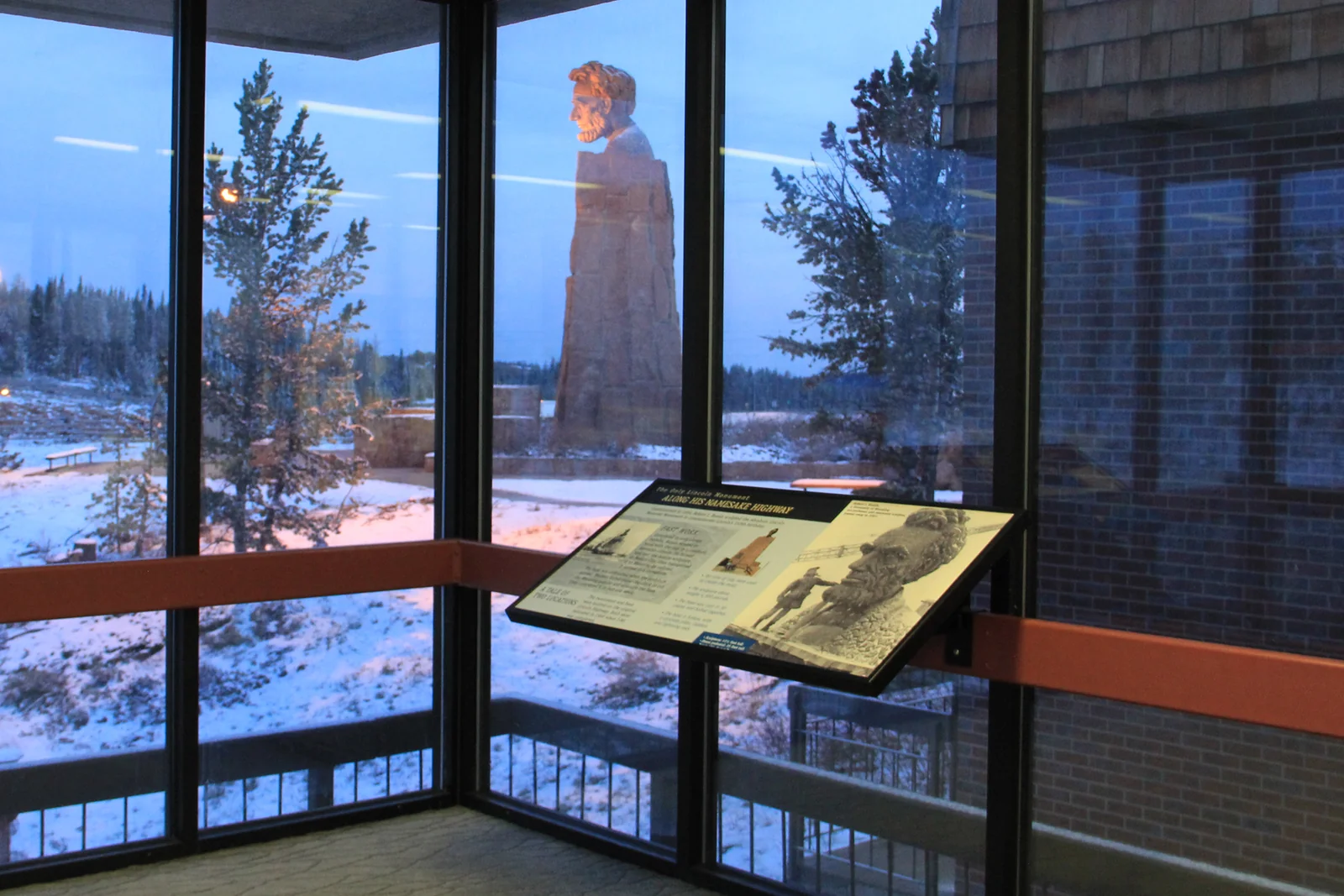
Cross into Wyoming and climb onto the high plains toward the Rockies. The highlight is Sherman Summit, around 8,640 feet — the highest point on the historic route — crowned by the bronze Lincoln Monument bust that watches over the interstate. Nearby stands the Ames Monument, a stark granite pyramid, before Cheyenne, Laramie, and Rawlins string out the day.
Wyoming → Salt Lake City, UT
The route crosses the empty Wyoming basin and drops into Utah toward Salt Lake City, the Wasatch rising ahead. West of the city you reach the edge of the Great Salt Lake Desert — where the original Lincoln Highway split into the notorious "cutoffs" that stranded early motorists. Take in that stark white expanse, then follow the modern alignment before the long desert crossing.
Nevada & the Great Basin → San Francisco, CA
The grand finish. On the Pioneer Branch the Lincoln Highway overlaps US 50 across Nevada — "the Loneliest Road in America" — through Great Basin ranges and outposts like Ely, Eureka, and Austin, with real distance between fuel stops. Reach Carson City, climb the Sierra Nevada over the Donner and Echo Summit country, drop into Sacramento, and run west to the terminus marker in Lincoln Park, San Francisco.
Only have one week?
The Lincoln Highway splits cleanly. Drive New York to the Mississippi for the Eastern corridor — the Heritage Corridor giants, the main streets, and Iowa's concrete relics; or the Plains to San Francisco for Wyoming's summit, the deserts, and the Sierra crossing. Build either half — your dates, your pace — in the planner.
Plan your Lincoln Highway trip →14 best stops on the Lincoln Highway
If you can't drive the whole thing, these are the stops worth building a trip around, east to west.
- Times Square, NYC — the eastern terminus marker and the start of the original American road trip.
- Lancaster & Pennsylvania Dutch Country, PA — the Lincoln Highway as a living main street through farm country.
- Gettysburg, PA — the Civil War battlefield sits right off the historic line, an easy half-day.
- The Coffee Pot, Bedford, PA — a 1920s pot-shaped building, the poster child for the corridor's roadside giants.
- Van Wert, OH & Ligonier, IN — courthouse-square small towns that show the road's Midwestern heart.
- DeKalb, IL — home of the Lincoln Highway Association, seedling markers, and the "ideal section" story.
- The Mississippi crossing at Fulton, IL — where the highway touches the Great River Road before Iowa.
- Tama, IA — the 1915 concrete bridge with "LINCOLN HIGHWAY" cast into its railings.
- Reed/Niland Cafe, Colo, IA — a restored 1920s roadside gas station and cafe, one of the best survivors.
- The Archway, Kearney, NE — a museum spanning I-80 that tells the trails-to-highways story.
- Sherman Summit, WY — the highway's high point (~8,640 ft) with the Lincoln Monument bust and nearby Ames Monument.
- Edge of the Great Salt Lake Desert, UT — the stark salt country of the original desert cutoffs (view it, don't drive it).
- The Great Basin & US 50, NV — the "Loneliest Road" overlap across empty, beautiful range country.
- Lincoln Park, San Francisco, CA — the western terminus marker, road's end at the Pacific.
Lincoln Highway vs Route 66: which should you drive?
These are the two great historic American road trips, and the Lincoln Highway is the elder statesman. Route 66 was numbered in 1926 and runs a shorter southern line to the desert Southwest; the Lincoln Highway came first, in 1913, and crosses the full width of the country on a northern arc. With Route 66 drawing big crowds for its 2026 centennial, the Lincoln Highway is the quieter, older alternative — and it feeds the wider America-250 interest in founding-era history.
| Lincoln Highway | Route 66 | |
|---|---|---|
| First opened | 1913 (first transcontinental road) | 1926 |
| Length | ~3,400 mi coast to coast | ~2,448 mi |
| Direction | New York → San Francisco (E–W) | Chicago → Santa Monica (E–W) |
| Route / corridor | US 30 East/Midwest, I-80 corridor West | Old US 66 alignments |
| Status today | Unsigned; follow historic markers & a guide | Decommissioned 1985; old alignments |
| Vibe | First-road history, quiet, coast to coast | Nostalgia, neon, roadside Americana |
Short version: drive Route 66 for the myth, the motor courts, and the centennial energy; drive the Lincoln Highway for the history of the very first coast-to-coast road, the full width of the continent, and the quiet.
Costs and practical tips
A rough per-person budget for the full ~21-day drive, based on two people sharing a car and mid-range motels. These are planning estimates, not live prices — check current fuel and lodging before you book.
| Item | Estimate | Notes |
|---|---|---|
| Fuel | $390–$490 (whole car) | ~3,400 mi at ~28 MPG ≈ 120 gallons. |
| Lodging | $110–$190 / night | Cheaper across the Midwest and Plains; cities and the Sierra cost more. |
| Food | $45–$70 / person / day | Diner and main-street country most of the way; splurge in the cities. |
| Museums & sights | $100–$200 / person total | Mostly small local museums and roadside stops rather than pricey parks. |
| 21-day total | ~$3,000–$4,500 / person | Two sharing a car; less if you camp, more with a one-way rental fee. |
Practical tips
- Navigate by a Lincoln Highway guide, not just GPS. The route was realigned many times; a dedicated map keeps you on the historic line instead of the interstate.
- Do not drive the original desert cutoffs. Some original alignments — especially the Great Salt Lake Desert cutoffs — are gravel or impassable and genuinely dangerous; take the modern alignment.
- Time the passes. Cross the Wyoming high country and the Sierra Nevada in summer or early fall, and check conditions before committing a day in the shoulder seasons.
- Mind the gaps out west. Fuel up before the Great Basin and the Wyoming basin — towns and services are far apart, and cell coverage thins with them.
Lincoln Highway FAQ
How long does it take to drive the Lincoln Highway?
Plan on two to three weeks for the full ~3,400-mile route — 21 days is ideal, 14 the honest minimum. The whole point is the detours, so racing it misses the value. With less time, drive one half: New York to the Mississippi, or the Plains to San Francisco.
Where does the Lincoln Highway start and end?
It runs east to west from a marker near Times Square in New York City to the western terminus marker in Lincoln Park, San Francisco — roughly 3,400 miles across about 14 states. The historic direction is New York to San Francisco.
Can you still drive the Lincoln Highway today?
Yes, but it isn't a single signed highway anymore. You follow it along US 30 and the I-80 corridor, guided by historic markers and a route guide. Some original alignments are gravel or impassable — notably the desert cutoffs in Utah — so most travelers stick to the modern drivable alignment.
Lincoln Highway vs Route 66: which is older?
The Lincoln Highway is older. It was dedicated in 1913 as America's first transcontinental road, more than a decade before Route 66 was numbered in 1926. It's also much longer and crosses the entire country, while Route 66 ran a shorter southern line from Chicago to Santa Monica.
What states does the Lincoln Highway go through?
The main modern route touches about 12 core states — New York, New Jersey, Pennsylvania, Ohio, Indiana, Illinois, Iowa, Nebraska, Wyoming, Utah, Nevada, and California — and counting its many historic realignments, it's often described as crossing roughly 14 states.
When is the best time to drive the Lincoln Highway?
Summer through early fall, when the Wyoming basin and Sierra Nevada crossings are open and clear of snow. September and early October are the sweet spot — thinner crowds and fall color in the East. Avoid winter for the full route, when the western passes and deserts turn hazardous.
Turning this into your Lincoln Highway trip
The Lincoln Highway rewards a simple plan: pick your window (summer or early fall), decide whether you're driving the full coast-to-coast or one half, and pace the days so each ends in a real town rather than an empty stretch of the West. Load a Lincoln Highway guide for the historic alignments, and keep the desert cutoffs on the do-not-drive list. Then point the car west, follow the markers, and drive the road that started it all.
Plan your own Lincoln Highway trip
Turn this itinerary into a personalized plan — your dates, your pace, your car — with a live map, daily driving times, weather, fuel estimates, and where-to-stay links.
Open the planner →