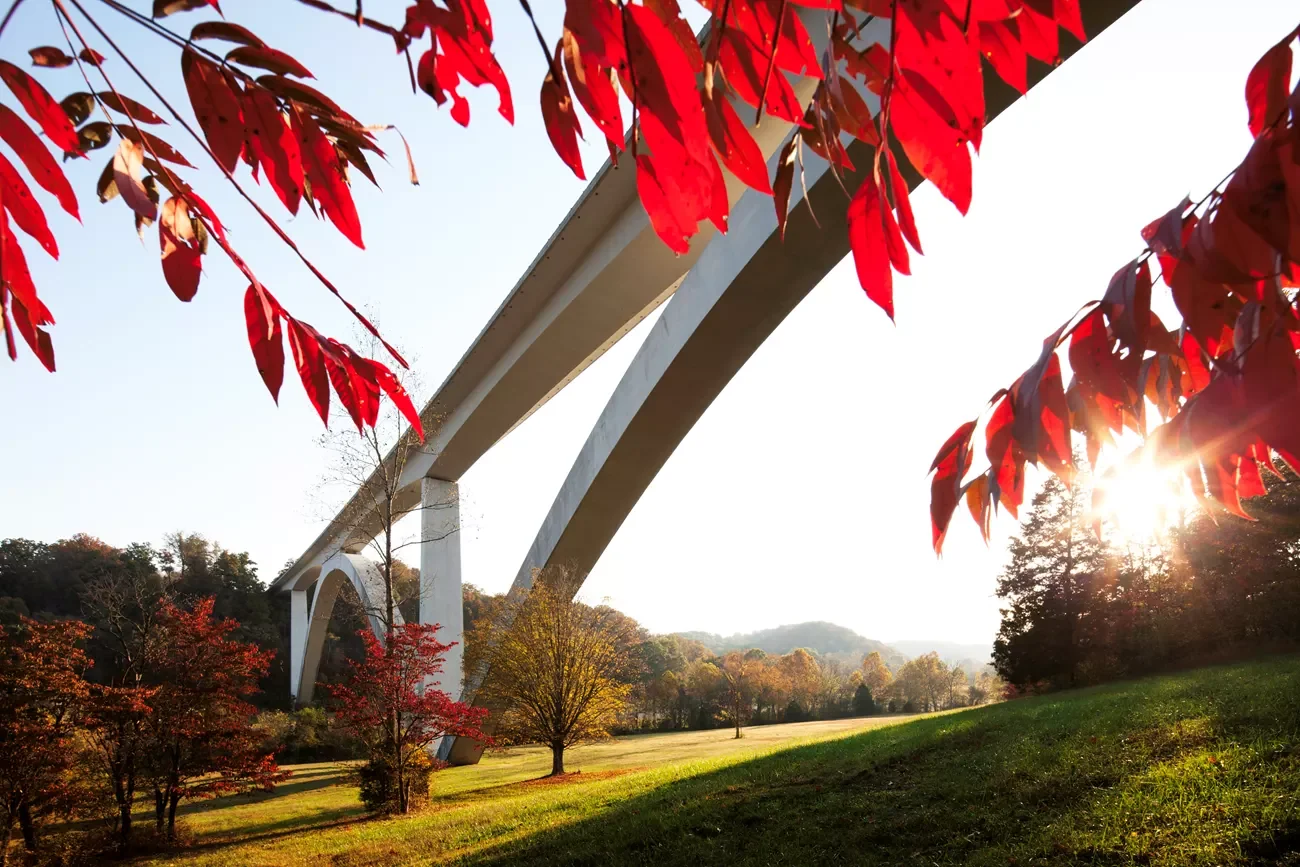
The Natchez Trace Parkway is a 444-mile National Park Service road that runs from Nashville, Tennessee down to Natchez, Mississippi — clipping the northwest corner of Alabama on the way and tracing the route of the historic Old Natchez Trace. There are no commercial trucks, no billboards, almost no traffic lights, and a low ~50 mph limit the whole way, which is why it's so often called the Blue Ridge Parkway of the South. It's measured by milepost, counting down from MP 444 at Nashville to MP 0 at Natchez. Here's the full drive, north to south — the honest pacing, the stops worth your time, and how it stacks up against the Blue Ridge.
The Blue Ridge Parkway of the South — 444 unhurried miles down the Old Natchez Trace.
What the Natchez Trace Parkway actually is
The Natchez Trace Parkway is a single, continuous National Park Service parkway — one road, start to finish, not a network of local highways. It runs 444 miles from just southwest of Nashville down to Natchez, following the corridor of the Old Natchez Trace — a route worn first by Native peoples, then walked by the "Kaintuck" boatmen who floated goods down the rivers to Natchez and had to hoof it home overland. Post riders, settlers, and Andrew Jackson's army used it too, and Congress later protected it as a memorial parkway that the NPS built and runs along the old line.
The appeal is mostly what's missing. No commercial trucks, no billboards, hardly a traffic light, and a steady ~50 mph limit make it one of the calmest long drives in the country — a thin linear national park more than a highway. The flip side is worth knowing up front: there is nothing commercial on the parkway — no gas, no restaurants, no motels, so you exit to the towns for all of that. What it does have is layers of history — ceremonial mounds, restored frontier inns, Meriwether Lewis's grave — getting fresh attention in the America-250 era of looking back at the country's early routes.
Natchez Trace Parkway map
The parkway at a glance — Nashville down to Natchez, by milepost.
When to go
The Trace runs through the mild mid-South, so it's drivable in every season and rarely closes — but two windows are the reason to build a trip around it.
Spring (roughly late March through April) is the classic. Flowering dogwoods, redbud, and wildflowers light up the woods, temperatures are comfortable, and the summer humidity hasn't set in. It's also when Natchez runs its spring house-tour season, so the southern end is at its liveliest.
Fall is the sleeper pick. Color comes late on the Trace — the hardwoods here tend to peak from late October into November, weeks after New England and the northern mountains have dropped their leaves. That makes the parkway a genuine catch for anyone who missed peak color up north and still wants a foliage drive. Summer is green and humid but fine; winter is bare, quiet, and open. One honest caveat: fall-color timing shifts year to year, so if foliage is the point, check recent reports before you lock your dates.
Direction, pacing, and logistics
Drive north to south
Go Nashville to Natchez. The mileposts count down from 444 to 0 the way you drive, so navigation is dead simple, and the trip builds the right way — from the Tennessee hills through the woods and mounds of Mississippi to an old river town on the bluffs above the Mississippi. Ending at Natchez also drops you onto the Great River Road if you want to keep following the water south.
How long it honestly takes
The full 444 miles is only about nine hours of pure driving at the parkway's slow speed limit, so this is a short road trip by mileage — three comfortable days, two if you're pushing, four or five to linger over the history. The reward is the frequent pullouts, short trails, mounds, and overlooks, so don't treat it like a highway to knock out. The daily drive-time caps in our planning guide apply even though the legs look tiny: a 50 mph road with a dozen stops a day is slower than the map suggests, and slow is the point.
No services on the parkway
This is the one logistic that trips people up: there are no gas stations, restaurants, or lodges on the parkway itself. Everything is in the gateway towns just off it — Franklin, Florence, Tupelo, the Jackson area, and Natchez. Fuel up and eat before long empty stretches (the run between Tupelo and Jackson is the big one), and plan overnights a few minutes off the road. It's a one-way trip, so most people fly into Nashville and home from a nearby hub with a one-way rental.
The Natchez Trace itinerary, milepost by milepost
Here's the parkway in five unhurried segments, north to south, keyed to the mileposts that mark every stop. Combine the short days and you'll drive it comfortably in three; take all five and you can give the swamp boardwalk, the mounds, and Natchez the time they deserve. Mileages are planning estimates for the parkway routing — build in extra time for the pullouts.
Nashville (MP 444) to the Meriwether Lewis area (MP 386)
Start at the northern terminus southwest of Nashville and ease onto the parkway. A few miles in you cross the Double Arch Bridge at Birdsong Hollow (MP 438), the Trace's signature span, arching over a valley with an overlook alongside. Stretch your legs at Jackson Falls (MP 405), a short steep walk down to a two-tier waterfall, then finish near the Meriwether Lewis Monument and gravesite (MP 386), where the co-leader of the Lewis and Clark expedition died under still-debated circumstances in 1809; overnight around Hohenwald.
Meriwether Lewis (MP 386) to Tishomingo State Park (MP 302)
This is the day you touch three states. The parkway slips across the northwest corner of Alabama — its shortest state section — near Florence and the Tennessee River, then crosses into Mississippi. Aim for Tishomingo State Park (near MP 302), where a swinging footbridge, mossy sandstone outcrops, and Civilian Conservation Corps-era stonework make for the prettiest short hike on the northern half — a quiet, low-mileage day built for wandering.
Tishomingo (MP 302) to Tupelo (MP 266)
A short drive on purpose, because Tupelo earns a full day. The Parkway Visitor Center near MP 266 is the road's headquarters, with the best exhibits anywhere on the Trace's history. Just off the parkway in town is the birthplace of Elvis Presley, the tiny two-room house where he was born, now a small museum and park. Spend the afternoon here and sleep in town.
Tupelo (MP 266) to the Cypress Swamp (MP 122) & Jackson area
The longest leg, and the emptiest — the middle miles roll through pine and hardwood with few towns in sight. The payoff near the end is the Cypress Swamp (MP 122), a short boardwalk loop over still black water through bald cypress and water tupelo, one of the most atmospheric quick stops on the road. Watch for the mound and old-Trace pullouts along the way, and overnight around Jackson or the Clinton area just off the parkway.
Jackson area to Natchez (MP 0), via Mount Locust & Emerald Mound
The finish is the most historic stretch. Near the southern end, Mount Locust (MP 15) is a restored inn, or "stand," one of the lodging houses that once dotted the old Trace for travelers walking north. A few miles on, Emerald Mound (MP 10) is one of the largest Native American ceremonial mounds in the country — a huge flat-topped earthwork you can climb. Then the parkway ends at Natchez (MP 0), an antebellum river town on the bluffs above the Mississippi, with grand old homes, a walkable historic district, and long views over the water.
Only have a weekend?
The Trace is short enough to do in two days if you pick your half. Drive Nashville to Tupelo for the hills and waterfalls, or Tupelo to Natchez for the swamp, the mounds, and the river town. Build either half — your dates, your pace — in the planner.
Plan your Natchez Trace trip →12 best stops on the Natchez Trace
If you can't drive the whole thing, these are the stops worth building a trip around, north to south by milepost.
- Nashville, TN (MP 444) — the northern terminus, with Franklin's historic square minutes away.
- Double Arch Bridge, Birdsong Hollow (MP 438) — the parkway's iconic span, arching over a wooded valley with an overlook alongside.
- Jackson Falls (MP 405) — a short, steep trail down to a pretty two-tier waterfall.
- Meriwether Lewis Monument & gravesite (MP 386) — the burial site of the famed explorer, who died here in 1809 under still-debated circumstances.
- The Tennessee–Alabama–Mississippi tri-state stretch — where the parkway clips Alabama's northwest corner near Florence and the Tennessee River.
- Tishomingo State Park, MS (near MP 302) — a swinging footbridge, sandstone bluffs, and the best short hike on the northern half.
- Parkway Visitor Center, Tupelo (MP 266) — the road's headquarters, with the fullest exhibits on the Trace's history.
- Elvis Presley Birthplace, Tupelo — the tiny house where Elvis was born, just off the parkway, now a small museum and park.
- Cypress Swamp (MP 122) — a short boardwalk loop over black water through bald cypress and water tupelo.
- Mount Locust (MP 15) — a restored frontier inn, or "stand," one of the old lodging houses along the historic Trace.
- Emerald Mound (MP 10) — one of the largest Native American ceremonial mounds in the U.S., a huge earthwork you can climb.
- Natchez, MS (MP 0) — the antebellum river town at the southern end, on the bluffs above the Mississippi and the Great River Road.
Natchez Trace vs Blue Ridge Parkway: which should you drive?
They're the two great National Park Service parkways in the East, and they invite the comparison — the same idea of a slow, trafficless, billboard-free scenic road, executed in very different country. The Blue Ridge is a mountain drive with big elevation and famous overlooks; the Natchez Trace is a gentler, more historic drive through mid-South forest. If you're choosing between them, here's what matters.
| Natchez Trace Parkway | Blue Ridge Parkway | |
|---|---|---|
| Length | ~444 mi (TN, AL, MS) | ~469 mi (VA, NC) |
| Traffic & trucks | No trucks; very light traffic | No trucks; busy near towns and in fall |
| Terrain & elevation | Gentle hills, low elevation | High mountains, up to ~6,000+ ft |
| Fall-color timing | Late — late October into November | Earlier — early-to-mid October up high |
| Crowds | Low, most of the year | High at peak fall |
| Vibe | History, forest, quiet | Mountain vistas and overlooks |
Short version: drive the Blue Ridge Parkway for mountain grandeur and classic overlooks, and the Natchez Trace for history, solitude, and later, quieter fall color. And because the Trace ends at Natchez right on the river, it links cleanly to the Great River Road if you want a longer Southern loop.
Costs and practical tips
A rough per-person budget for the 3-day drive, based on two people sharing a car and mid-range motels. These are planning estimates, not live prices — check current fuel and lodging before you book.
| Item | Estimate | Notes |
|---|---|---|
| Fuel | $50–$75 (whole car) | ~444 mi at ~28 MPG ≈ 16 gallons; remember there's no gas on the parkway itself. |
| Lodging | $110–$180 / night | Gateway-town motels and inns; Natchez and spring weekends run higher. |
| Food | $40–$65 / person / day | All in the towns off the parkway — Franklin, Tupelo, Jackson, Natchez. |
| Attractions | $30–$80 / person total | The parkway and mounds are free; Natchez house tours and the Elvis birthplace are ticketed. |
| 3-day total | ~$400–$700 / person | Two sharing a car; less if you camp, more with a one-way rental fee. |
Practical tips
- No services on the parkway. Fuel and food are only in the gateway towns — top up before the long empty run between Tupelo and Jackson.
- Navigate by milepost. Everything is signed from MP 444 (Nashville) down to MP 0 (Natchez); it's the simplest way to find every stop.
- Fall color comes late and varies. Peak is usually late October into November on the Trace — don't lock dates around foliage without checking recent reports.
- Book Natchez ahead in spring. The town's spring tour season and fall weekends fill its inns, so reserve the southern end early.
Natchez Trace Parkway FAQ
How long does it take to drive the Natchez Trace Parkway?
Three days is comfortable for the full 444 miles, two if you're moving, and four or five to linger over the history. Pure driving time is only about nine hours at the parkway's slow limit, but the whole point is the frequent stops — mounds, waterfalls, boardwalks, and overlooks — so give yourself more than the mileage suggests.
What is the Natchez Trace Parkway?
It's a 444-mile National Park Service parkway running from Nashville, Tennessee to Natchez, Mississippi, through the northwest corner of Alabama, following the historic Old Natchez Trace. There are no commercial trucks, no billboards, almost no traffic lights, and a low ~50 mph limit the whole way, which is why it's often called the Blue Ridge Parkway of the South.
Natchez Trace vs Blue Ridge Parkway: which is better?
Both are slow, trafficless NPS parkways, but they're set in different country. The Blue Ridge Parkway is a high-elevation mountain drive with famous overlooks and earlier, busier fall color; the Natchez Trace is a gentler, lower, more historic drive through mid-South forest, with later and much quieter fall color. Choose the Blue Ridge for mountain scenery, the Trace for history and solitude.
When is the best time to drive the Natchez Trace?
Spring and fall. Spring (late March–April) brings dogwoods and wildflowers before the summer humidity. Fall color arrives late here — usually late October into November — which makes the Trace a good option if you missed peak foliage farther north. Summer and winter are both drivable; timing varies year to year, so check before you commit.
Is there gas or food on the Natchez Trace Parkway?
No. There are no gas stations, restaurants, or lodges on the parkway itself — it's kept commercial-free by design. You exit to the gateway towns (Franklin, Florence, Tupelo, the Jackson area, Natchez) for fuel, meals, and rooms, so fill up and eat before long stretches like the run between Tupelo and Jackson.
Which direction should you drive the Natchez Trace?
North to south, Nashville to Natchez. The mileposts count down from 444 to 0 as you go, so navigation is easy, and the trip builds naturally from the Tennessee hills to the historic river town of Natchez on the Mississippi — where you can pick up the Great River Road if you want to keep going.
Turning this into your Natchez Trace trip
The Trace rewards a simple plan: pick your window — spring for the dogwoods, or late fall for color that peaks after everywhere else — decide whether you're driving the whole 444 miles or one half, and book your overnights in the gateway towns rather than the road itself. Then set the mileposts counting down and let the history unspool from Nashville to the river.
Plan your own Natchez Trace trip
Turn this itinerary into a personalized plan — your dates, your pace, your car — with a live map, daily driving times, weather, fuel estimates, and where-to-stay links.
Open the planner →